Dak Chaliou Dams Hydropower info by Hobo Maps- Go to Hydropower Projects Page - - Home
Dak Chaliou 1 & 2 Hydropower projects are still in planning and precise locations are not available so we are using a single location for both projects at coordinates 15°24'26.9"N 107°24'25.9"E (15.407466, 107.407204) as seen in image below.
The Dak Chaliou 1 & 2 projects have a big problem with the diversion of upriver waters away from their locations by the Xekaman 3 HPP which has a 7 km tunnel that takes water from the Nam Pagnou (river) and reservoir southeast to their powerhouse downriver from the Dak Chaliou proposed sites. This diversion takes most of the Nam Pagnou flow and bypasses the Dak Chaliou proposed sites as shown on satellite image map below:

Dak Chaliou 1 concept images below:


Dak Chaliou 2 concept images below:


Not sure who the owners of the two projects will be.
Vientiane Automation and Solution Engineering (VASE) is involved with this project in the planning stage.

Dak Chaliou stats chart below for both projects.

Catchment area of Dak Chaliou 1 at dam site is 170 Km2. Normal water level is 535 m and Dead water level is 534 m. Area of reservoir surface confirming to normal water level is 0.03 square km.
Catchment area of Dak Chaliou 2 at dam site is 125 Km2. Normal water level is 685 m and dead water level is 681 m. Area of reservoir surface confirming to normal water level is 0.049 square km.
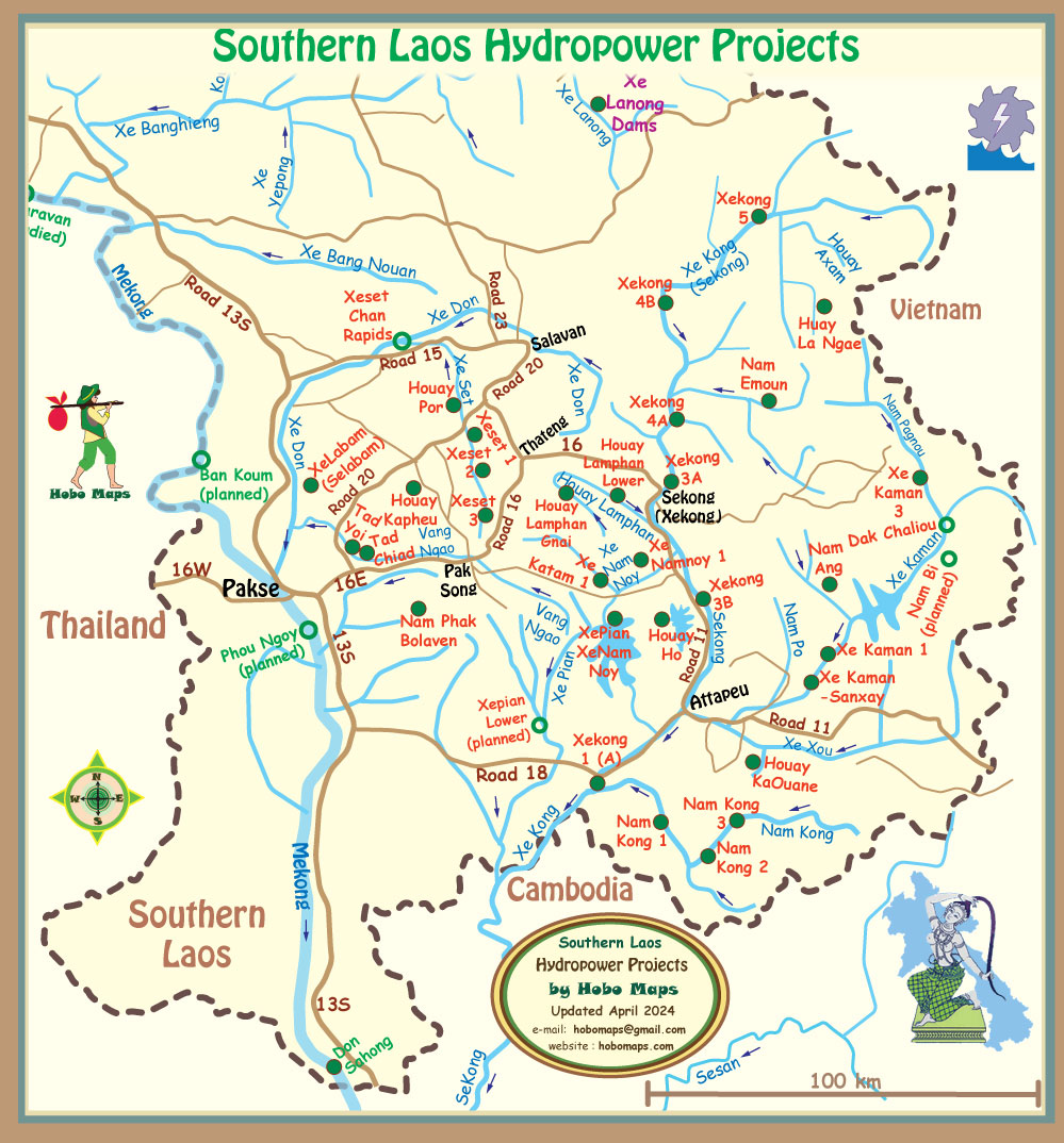
Dak Chaliou hydropower project site is seen in right side of map below.