Houay Yoi Hydropower Info by Hobo Maps - Go to Hydropower Projects Page - - - Home
In June 2022 while updating our Tad Chiad hydropower web page we discovered another hydropower project nearby under construction in the satellite images.
We have info from a 2016 Ministry of Energy and Mines report that indicates the project may be called the Houay Yoi-H. Kod hydropower project. We have no idea why Houay Kod is added to the name of the project.
This 2016 report has the Houay Yoi hydropower project rated at 11.2 MW capacity with 56 GWh annual output potential but gives no other details.
A 2020 JICA report verifies the MW as 11.2 and describes it as a Run of River project.
The Houay Yoi powerhouse coordinates are 15°12'15.6"N 106°04'32.9"E (15.204339, 106.075800) in the satellite image below. This image also shows portions of the Tad Chiad hydropower project in the same area.

The powerhouse for the Houay Yoi project is only 200 meters north of the Tad Chiad powerhouse and both seem to discharge their tailrace water into the Vang Ngao river.
Our best guess is that the new project may divert water away from the Houay Yoi stream at the top of the Tad Yoi waterfall into a diversion channel that runs about 1.2 km down to a new penstock which carries the water about 400 meters to the powerhouse with a blue roof.
As a result of this diversion, the waterfall would probably have greatly reduced flow most of the year which is regretable because the images below show quite a high and nice waterfall.
Tad Yoi waterfall image below:

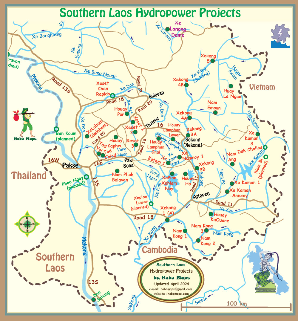
Houay Yoi (Tad Yoi) hydropower project is located next to the Tad Chiad project as seen in mid-left part of Southern Laos map below between Pakse and Pak Song: