
Nam Che 1 Dam Hydropower Info - Namche 1 Dam - by Hobo Maps- Go to Hydropower Projects Page - - - HOME
Nam Che 1 Hydropower project is located near Namlong village and Samgorthong village, Thathom district, Xaisomboun Province, Lao PDR.
The project has a small dam and reservoir. The powerhouse contains two 8.4 MW Francis turbine-generator units for 16.8 MW total installed capacity.
The project developer, Nam Che 1 Hydropower Company Limited, is a joint venture between B. Grimm Power Co. Ltd. (a unit of B. Grimm Group) and Daosavanh Co. Ltd. (an engineering company in Laos).
Nam Che is pronounced like "Nam Chay".
Nam Che 1 Dam location in satellite image below.
Power plant below located at coordinates 19°02'57.1"N 103°30'15.2"E (19.049196, 103.504230)

Dam structure below located at coordinates 19°03'17.1"N 103°30'48.6"E (19.054753, 103.513500)

The Nam Che 1 Hydropower plant project has been generating and supplying electricity to Electricte du Laos (EDL) since June 2019 (Commercial Operating Date).
EDL is to buy the power generated by the facility under a 25-year power purchase agreement.
The run-of-river hydro project is on the Nam Che River in Xaisomboun province and estimated to cost US$ 49 million.
Austria-based GLOBAL Hydro Energy was a major contractor for the project by providing a comprehensive turnkey package of electromechanical and control infrastructure.
Nam Che 1 Dam images below - we can see the Nam Chiane 1 penstock and power plant in the upper background not so far away and north of the Nam Che 1 dam and reservoir in the lower area of these images:


The dam structure is 23 meters high and 50 meters across with an overflow edge and two weir gates.
Sediment in the water is hopefully settled-out in a stilling chamber ahead of the high-pressure channel when flow velocity is reduced, possibly negating the need to install a desander.
Most of the 300-meter head water-descent stage is encased in an underground concrete conduit. The water then flows into an above-ground steel channel just before the power plant.
The power generated is conducted from the generator to medium-voltage switchgear, then to transformers and finally to a 15 km transmission line.
The project is shown in satellite image below - near National Road 1D that goes south from Plain of Jars and Muang Khoun towards Paksan.

Nam Che 1 & Nam Chiane Hydropower Project sites image below.

Nam Che 1 plant site images below:


Nam Che 1 powerhouse, penstock and switch yard images below:


Nam Che 1 administration building below:

Images of Nam Che 1 generators below:


Nam Che 1 plant building below:

Nam Che 1 switch yard image below:

Nam Che 1 project images below:


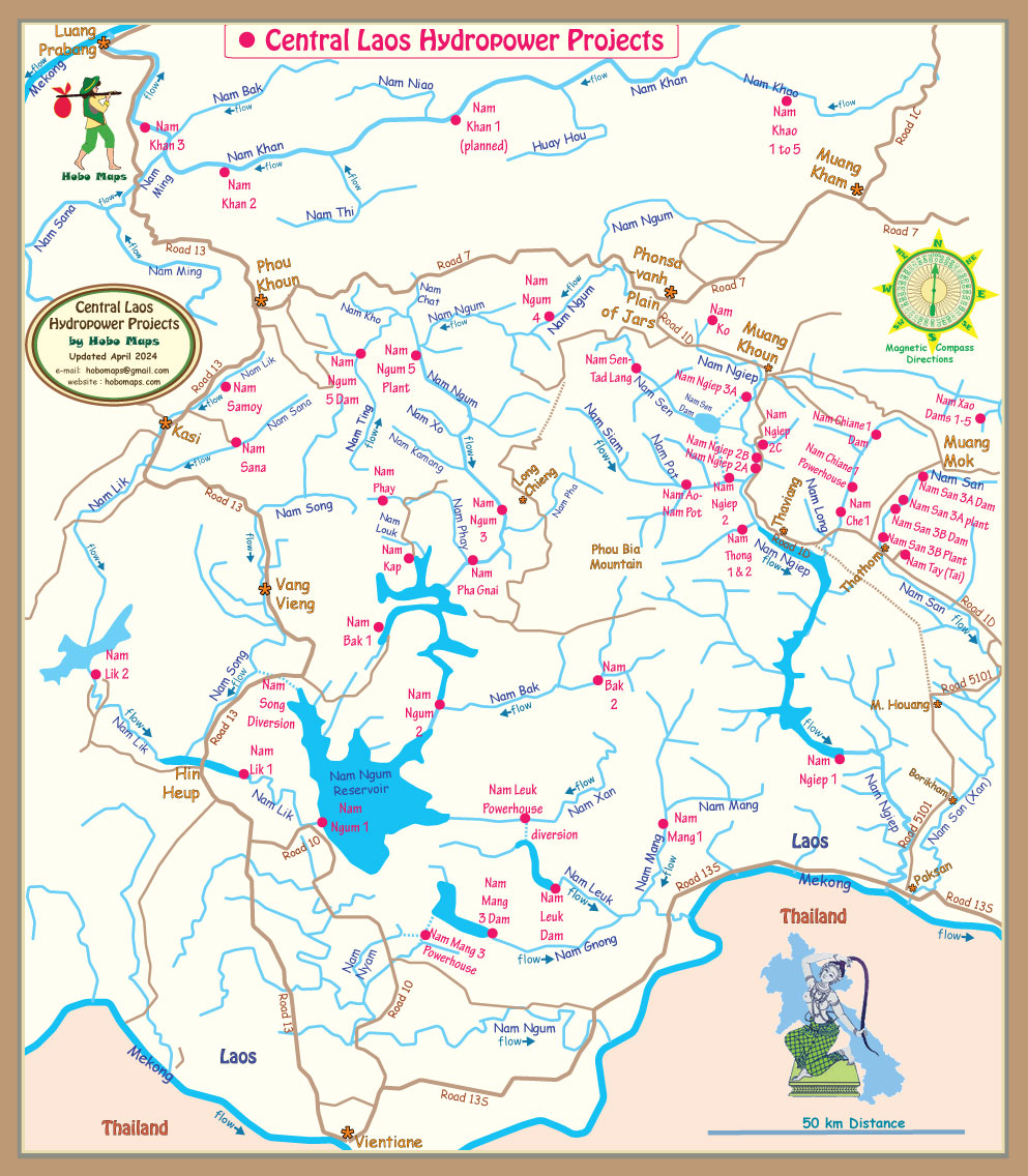
Nam Che 1 hydropower project shown at right side of map below:
Satellite image map below for Nam Ngiep River Basin hydropower projects:
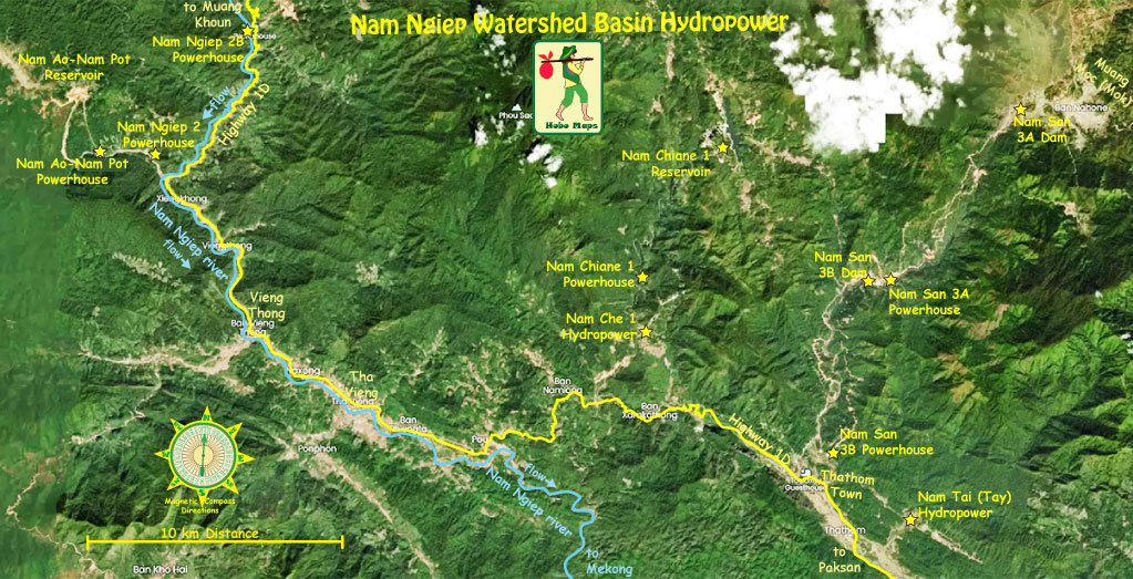
Nam Che 1 shown in watershed map below:

click HERE for more info about entire Nam Ngiep watershed catchment area