
Nam Samoy Dam Hydropower Info by Hobo Maps - Go to Hydropower Projects Page - - Home
Nam Samoy Hydropower project is near Phachao village, Kasy district, Vientiane Province, Lao PDR. The project site is close to where the Nam Samoy (stream) joins the Nam Lik (river) about 12 km north of Kasi (Kasy) town in Kasi District (close to the Highway 13 km marker 226) about 31 km south of Phou Khoun junction of National Roads 13 & 7.
Nam Samoy Dam hydropower project location is shown on satellite image below:
The Nam Samoy Dam hydropower project owner and developer is Namsamoy Hydropower. Co., Ltd. (a member of Malaysian-based OHP Group -https://www.ohpgroup.co/site-gallery) who will undertake the design, supply, construction, commissioning and completion of the project.
The project is in the high lands area of Phou Phachao mountain at elevations between 500 to 1200 meters above sea level and has a gross head of 340 meters.
The main weir is located downstream from the villages of Ban Bouak and Ban Longmark Khai. The weir site has a catchment area of approximately 50 square kilometers.
On February 12, 2020, Malaysia’s Kumpulan Powernet Bhd was given a US $15.9 million contract to construct the 8 MW Nam Samoy hydropower plant. The project is hoped to be completed within 18 months from start of construction. Construction was in progress and well underway in 2021 but the pandemic will probably cause delays.
A power purchase agreement (PPA) with Électricité du Laos (EDL) was executed in 2017 for the purchase of the electrical output generated from the Nam Samoy facility over a period of 28.5 years.
Nam Samoy Dam hydropower project site shown on image below. Powerhouse is located at coordinates - 19°17'43.1"N 102°20'38.8"E (19.295300, 102.344100)

Not sure about the size of the reservoir for the Nam Samoy dam. A prior 2014 CDM application form stipulates a 5 MW version of the project which would be a run-of-river type without a large reservoir but since the revised project in 2020 is now 8 MW, maybe there will be a larger sized reservoir. See bottom of this web page for CDM link and old project info.
Intake structure is located close to the powerhouse at coordinates - 19°17'44.9"N 102°20'39.5"E (19.295800, 102.344300)
Layout of Nam Samoy Dam hydropower project shown in diagram below that distorts geographic directions - north is not at the top:

Diagram of main facilities below:

Nam Samoy Dam hydropower project data charts below:


Estimated monthly power production chart below:

The project will have two Pelton turbine/generator sets at 4 MW each for 8 MW capacity with 36 GWh estimated annual output.

Construction in progress images below from various times:


Nam Samoy switchyard image below:

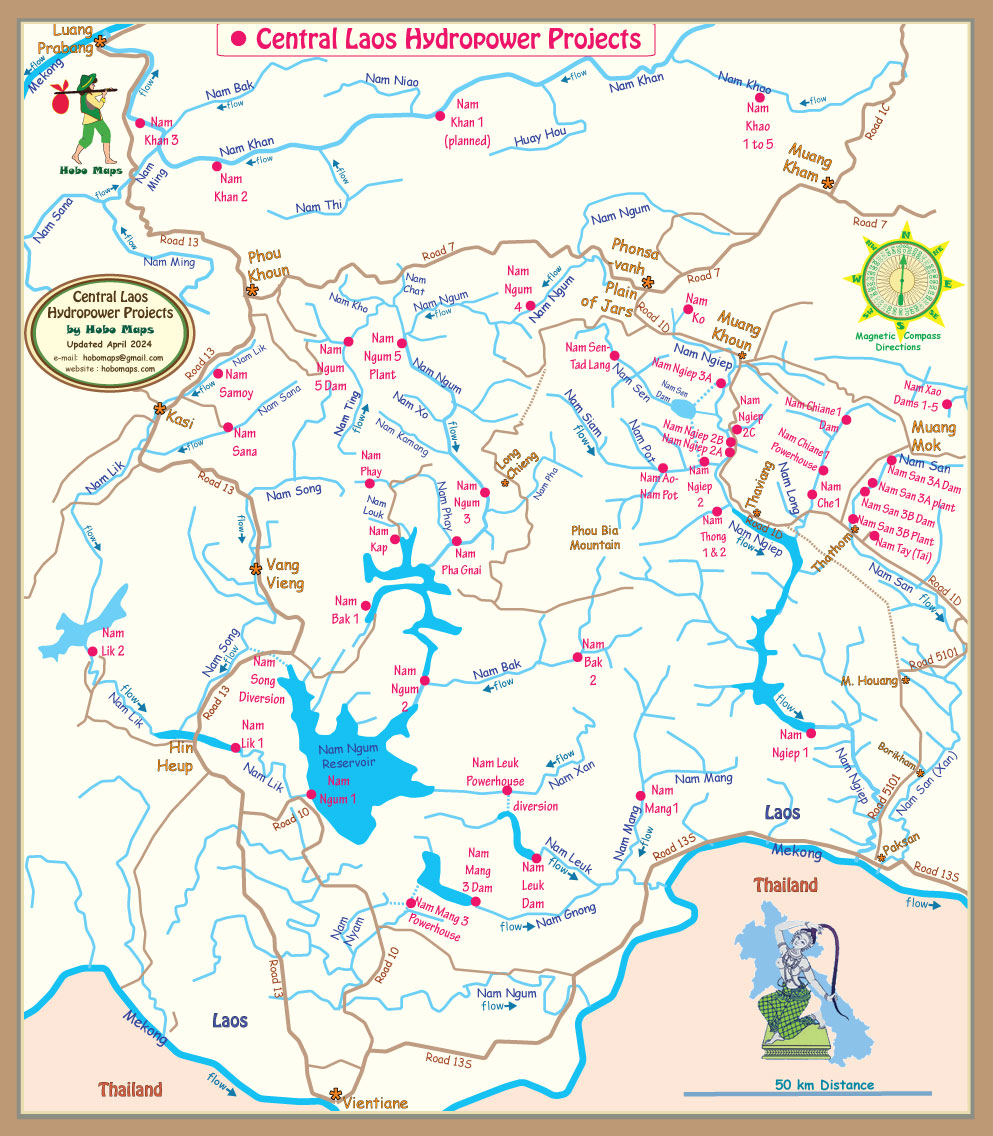
Nam Samoy Dam hydropower project location shown on left side of map below:
Nam Samoy Dam project located near km 225 marker on Highway 13 map below:

click to see full version of above Highway 13 map
The 8 MW Nam Samoy hydropower project discussed above may have some relationship with a 5 MW Nam Samoy project that was intended to qualify as a Clean Development Mechanism (CDM) project in a 2014 application with the same developer Nam Samoy Hydropower Co. Ltd.
See the CDM Application HERE.
The CDM Project site is located on the Nam Samoy River, Vientiane Province, Lao PDR.
The CDM Project is designed as a run-of-river hydropower project. The total installed capacity of the project would be 5 MW. The construction of the project includes fixed weir, a sandflush, intake, headrace channel, head tank, penstock, powerhouse and a tailrace. The annual net electricity supply for the project would be 28 GWh.
The power generated from the CDM Project would be delivered to EDL