
Nam Sen-Tad Lang Hydropower Info by Hobo Maps - Go to Hydropower Projects Page - - Home
The Nam Sen-Tad Lang hydropower project is located on the Nam Sen (river) just south of the Plain of Jars in Xieng Khouang Province, northern Lao PDR - at coordinates 19°16'54.0"N 103°11'19.0"E (19.281667, 103.188611) as seen on the satellite image below.
The Nam Sen flows eastward past Jar Site 3 at the Plain of Jars and then southeast to the Tad Lang waterfall which in the past was a popular tourist attraction. A small dam at the waterfall site now diverts most of the water flow into a concrete channel that goes southeast along a new road to the Nam Sen-Tad Lang Hydropower site.
The waterfall cascade now receives much less water flow since the diversion and most of the year is hardly worth a visit.
Nam Sen-Tad Lang hydropower project layout image below:

Nam Sen-Tad Lang hydropower is a 5 MW project with annual output capacity of 25 GWh.
We aren't sure who the current owner of the project is. Old reports indicate Bothong Insi Co., Ltd. may have been involved in development of the project.
The project has been completed and is currently producing output for domestic consumption in Laos.
Nam Sen-Tad Lang hydropower plant site image below:

Tad Lang waterfall site below at coordinates - 19°18'14.6"N 103°10'42.9"E (19.304059, 103.178577):

Tad Lang Waterfall image below.

Nam Sen-Tad Lang Hydropower site location can be seen in the upper area of map below:
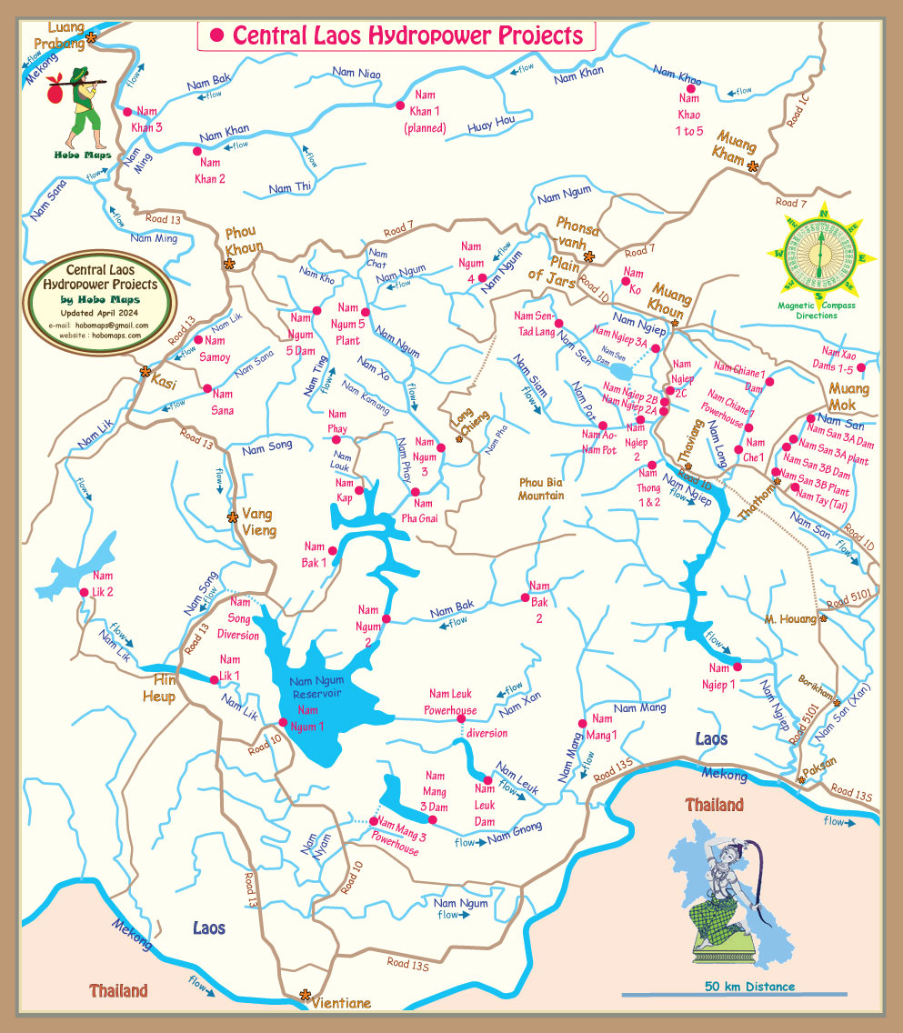
Southern Plain of Jars Map below shows Nam Sen Tad Lang location and access road at bottom

See our Plain of Jars Map for travel route to Tad Lang Waterfall and road south from there to Nam Sen-Tad Lang powerhouse site