Thakhek Loop Drainage Map - by HoboMaps.com - - - Home
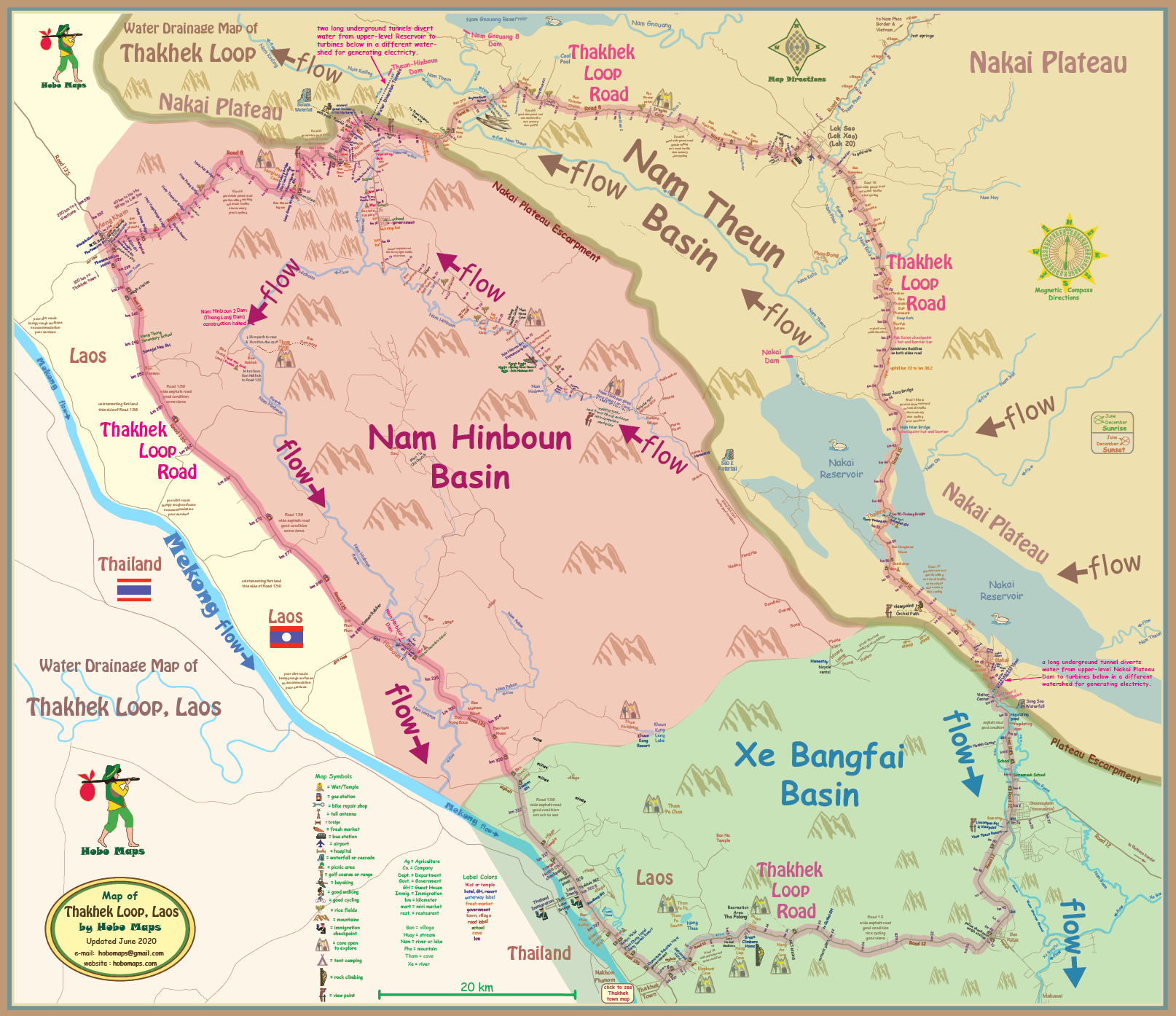
Map below shows flows of water in area surrounding the Thakhek Loop with all draining into Mekong River. Each of the three colored zones is a separate watershed basin. Underground tunnels from two dams transfer water from the Nam Theun Basin into the other two basins.
The Nam Theun (river) historically had all of its water flow into the Nam Kading (river) which joins the Mekong near Pak Kading at about the km 195 marker on Highway 13S. The Nam Theun 2 Hydropower project diverted much of the Nam Theun flow into the Xe Bang Fai (river) which joins the Mekong near the km 385 marker of Highway 13S. This diversion has decreased the natural Mekong flow along about 190 km of its length between the Nam Kading and Xe Bang Fai confluences.
The Theun-Hinboun Hydropower projects also have diverted waters from the Nam Theun (river) and from the Nam Gnouang (river) into the Nam Hinboun (river) which joins the Mekong near the km 288 marker of Highway 13S. This diversion has decreased the Mekong flow even more along the 93 km distance between the Nam Kading and Nam Hinboun confluences.
The natural flow of the Mekong past the Thakhek Loop area is now greatly reduced by the amount of these two inter-basin diversions. We can use the km markers of Highway 13S as measurement tools since that road runs close to and roughly parallel with the Mekong all along the area of the diversions.