Travel and Transport Info for Phonsavanh and Plain of Jars, Laos by Hobo Maps - - - Home
Click to see our Phonsavanh Map - Plain of Jars Map - Maps of Jar Sites 1, 2 & 3
Also our Plain of Jars Mysteries website
- Xieng Khouang is pronounced like "Shing Kwan" & Phonsavanh is pronounced like "Ponsavan"
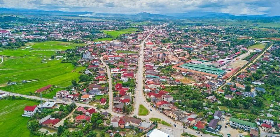
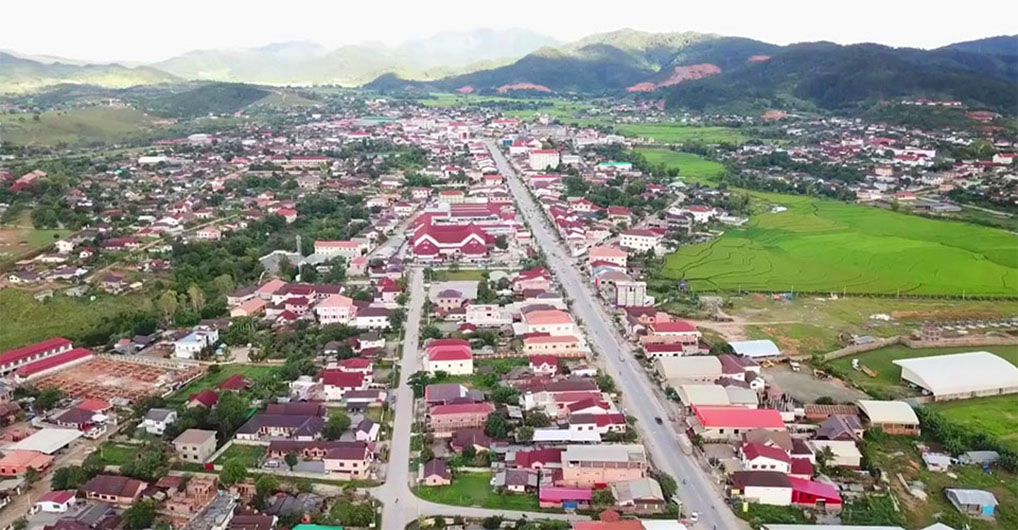
Phonsavanh town images below:
Tourist Info - the Provincial Tourism Office in Phonsavanh has recently moved and is now at grid code KI218 on this map HERE. The town has many travel agents and tour guide places in the central area.
Local Transport - the town of Phonsavanh is small enough to walk around but most other places of interest at the Plain of Jars require some sort of transport. Bicycles and motorbikes are available for daily rental but only at one or two places so be sure to arrive as early as possible to get one. Tuk tuks are the main taxis for visitors and drivers at the central town area usually speak a little English.
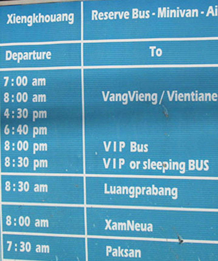
Long Distance Big Bus Service
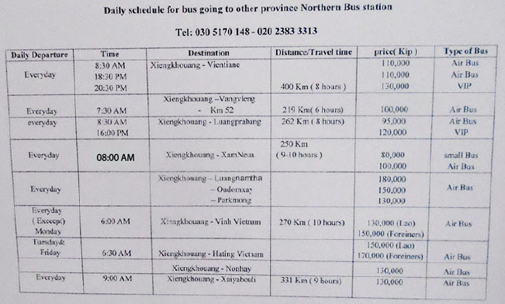
- The Xieng Khouang Bus Station (North Bus Station) has long distance big bus service to destinations outside of Xieng Khouang Province and is located about 3 km northwest of central Phonsavanh near the km 133 marker on Hwy. 7 at grid code JZ218 on this map HERE. The picture below is from a picture taken June 2019 at the bus station.
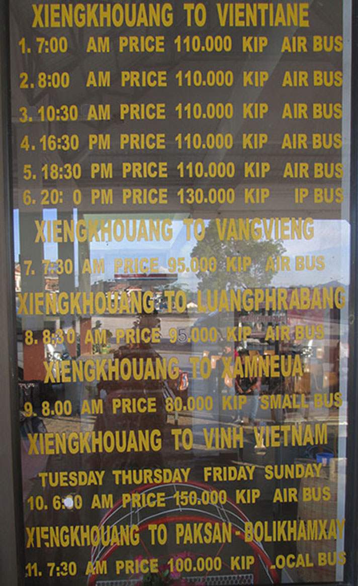
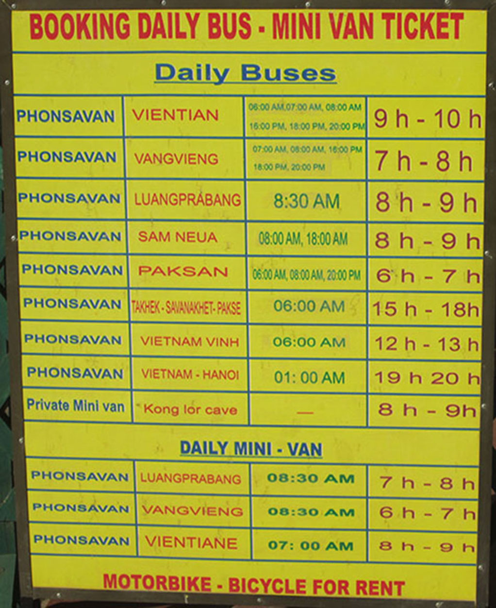
The Xieng Khouang Bus Station (North Bus Station) schedule below was posted at the tourism office June.
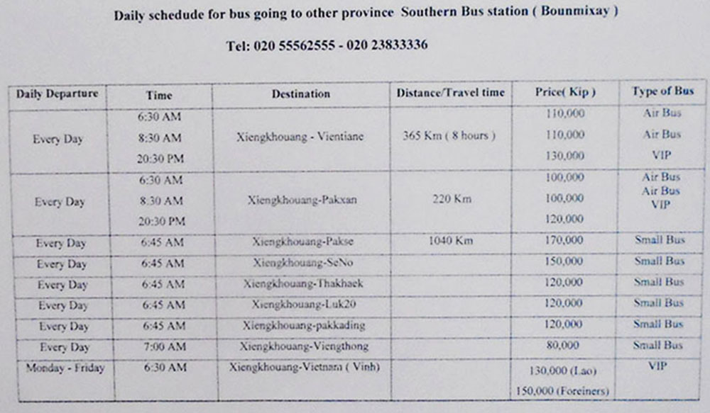
South Bus Station ( Bounmixay bus station) 4 km south of Phonsavanh on Highway 1D (at KP214 on this map HERE) has big buses going mostly to Paksan (Paxan) and Vientiane and smaller local buses (schedule below from picture taken June 2019 of schedule at Tourism Office).
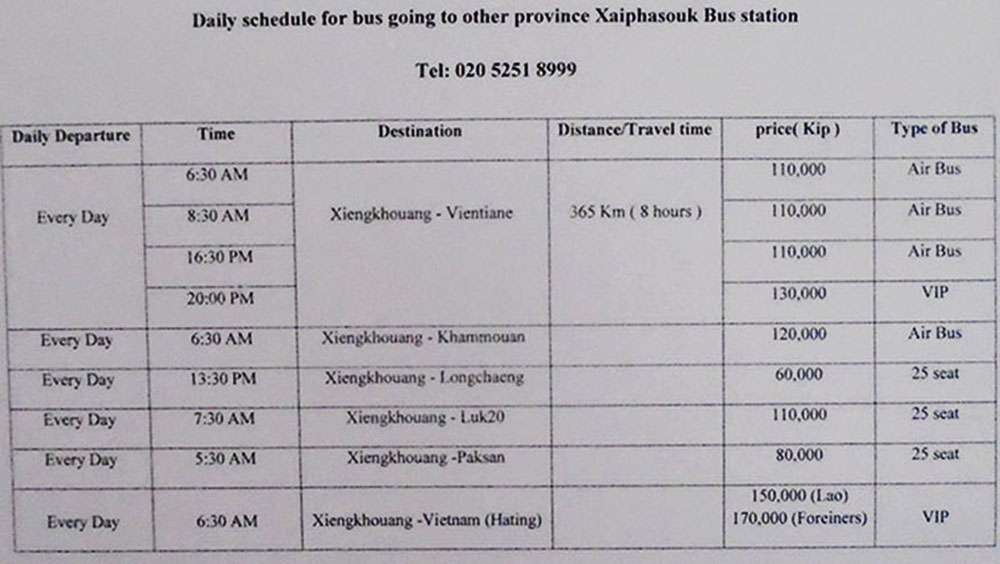
Xayphasouk long distant bus station (at grid code KM213 on our PDJ map HERE) schedule below from picture taken December 2019
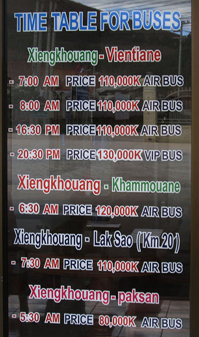
Xayphasouk long distant bus station schedule posted at tourism office June 2019 below. But the buses to Vietnam stopped running in mid 2020 due to border closures.
Minivan Bus Service
- The minivan bus station has recently moved and is now at the Phoukham Bus Station in Phonsavanh town at grid code KF238 on this map HERE.
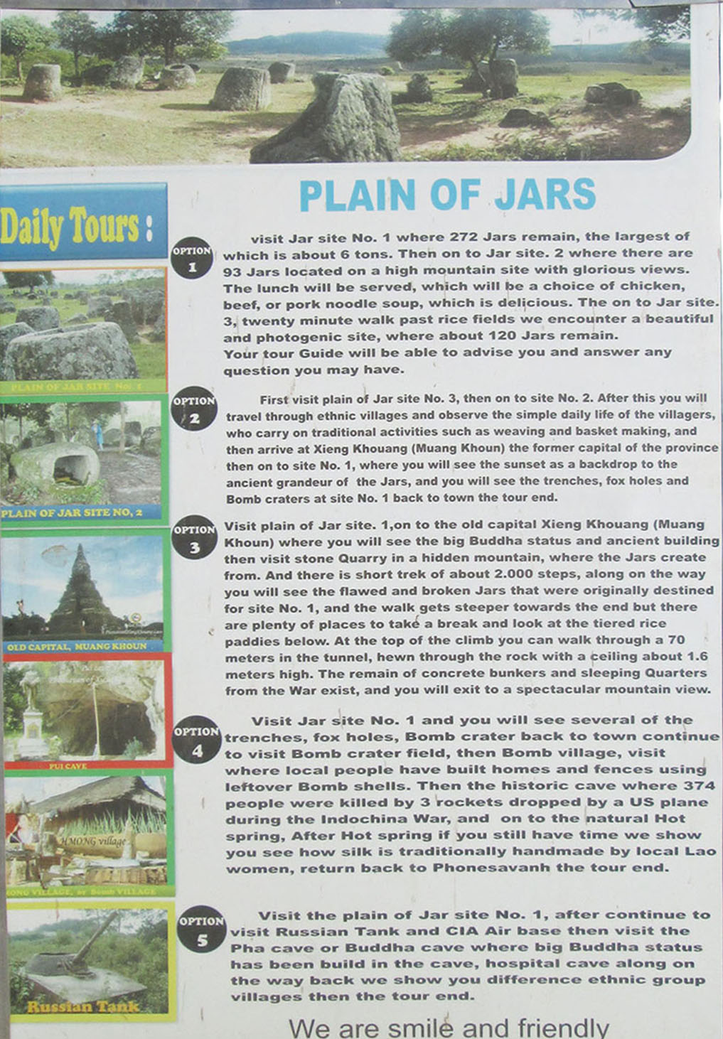
Quarry now open - the Phou Keng Quarry site was opened in early 2012 and is ready for visitors. It's located at grid code JN164 on this map HERE and can be reached by going south on the road that joins Hwy. 7 between km markers 125 & 126 west of Phonsavanh. There are signs at this junction. The quarry is about 18 km from central Phonsavanh via this route. About 1,000 concrete steps go up a steep ravine at the quarry site to the summit of Phou Keng mountain where there is a secret tunnel and a natural cave plus nice views. Unfinished jars lie on both sides of the steps for easy viewing. Entrance fee is 10,000 kip for adult non-Lao visitors. Many of the jars at Jar Site 1 are thought to have come from this quarry.
Tad Lang Waterfall - There used to be a waterfall not far from Jar Site 3 but the waterfall is gone as a new dam is diverting most of the Nam Sen water into a concrete water channel leaving only a trickle going down the natural river channel - not enough of a flow to create a waterfall.
Cycling trips - PDJ is great for bicycling or motorbiking with light traffic, fresh air and a feeling of wide open spaces - big sky country. Widespread pine tree reforestation in recent years is making the PDJ better for cycling each year with nicer views, more shade and a fresh pine smell as the trees mature.
- Cycling to Jar Sites 1, 2 & 3 - Site 1 is about 10 km from central town on paved roads but Sites 2 & 3 are much further south on rough dirt roads most of the way. It's about 24 km to Site 2 and 30 km to Site 3 from central town one way. A trip out to see all 3 sites would be about 38 km on the way out (including side trips to Sites 1 & 2) and 30 km back without side trips for a 68 km round trip total, with about 28 of that on nice paved roads and 40 km on rough dirt roads. Trying to visit all 3 sites by peddle bicycle in a single day is maybe too much if you want to get back before dark.
- Back Roads Route to Jar Sites 2 &3 - we have highlighted a back-roads route to Sites 2 & 3 on this map HERE. Most of this route is on quiet rural dirt roads away from people. Takes about 3.5 hours to peddle a bike one way between Phonsavanh town and Sites 2 & 3.
- Crater Mania cycling trip - much of the Plain of Jars was heavily bombed during the Secret War in Laos (1965 to 1973) and there are bomb craters all around the PDJ. We have found one small area that still has many big craters intact and visible which makes a nice cycling and photo op trip from Phonsavanh. This Crater Mania area is at grid code LW196 on THIS MAP with each crater marked by a red dot. The area is near Ban Thone North about 15 km southwest of Phonsavanh town.
Travel Agent sign pictures below taken June 2019
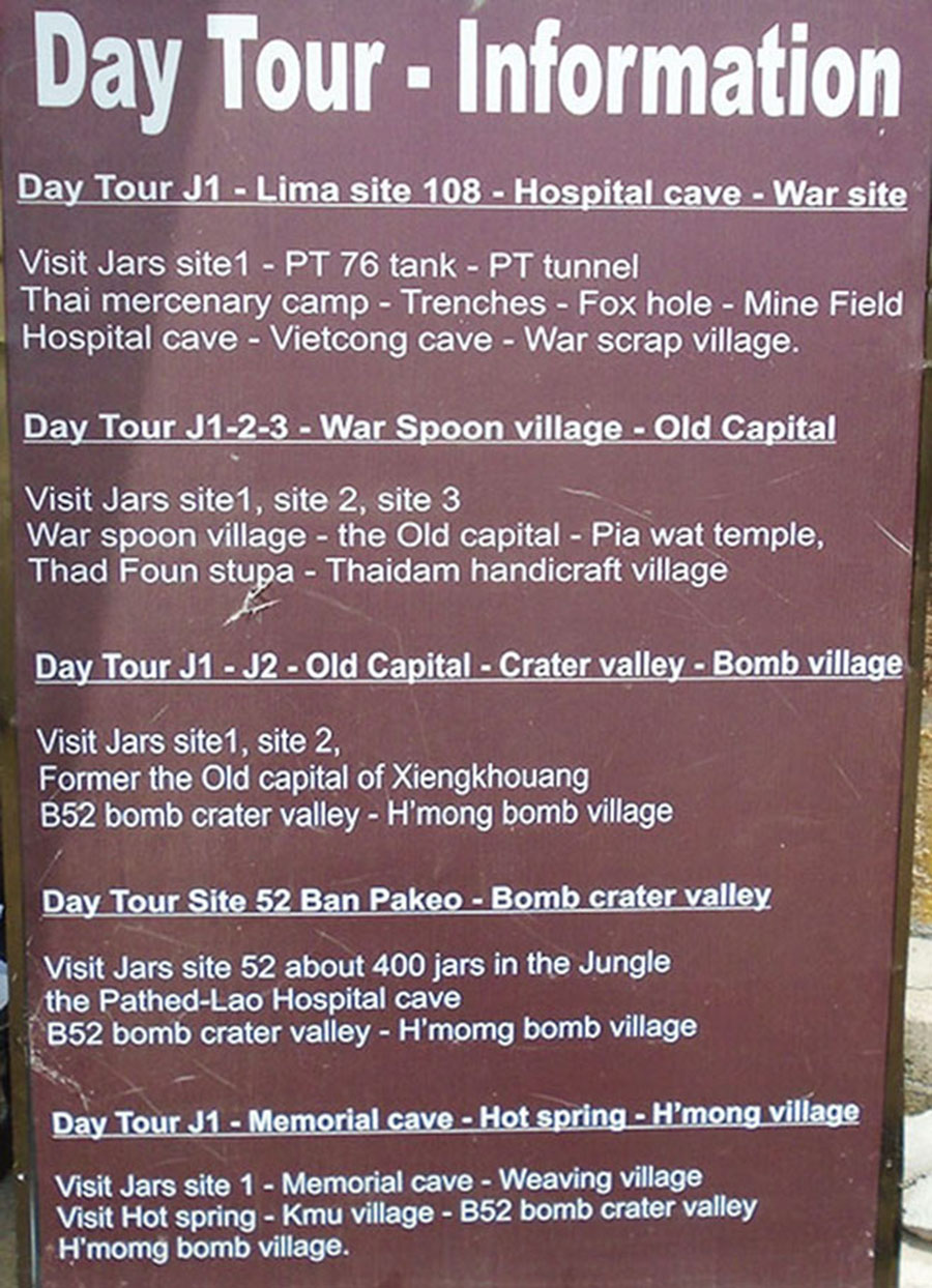
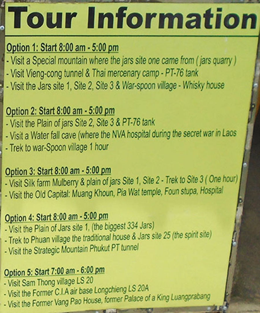
Travel Agent sign pictures below taken January 2017
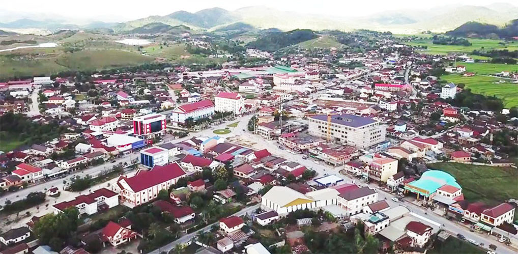
Another Phonsavanh town image below:
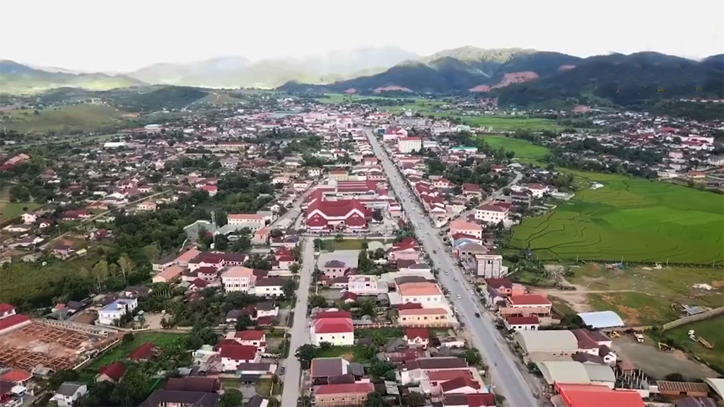
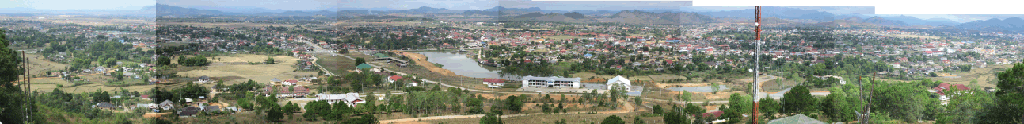
Panorama image of Phonsavanh town below:
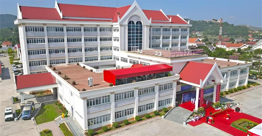
Lao-Vietnam Friendship Hospital below finished construction in 2023.