Houay Axam Hydropower Project Info by Hobo Maps - Go to Hydropower Projects Page - - - Home
In year 2018 an effort was made by Natural Heritage Institute (NHI) to encourage the Lao government (GOL) to preserve the Xekong (Sekong) as the last major free-flowing tributary to the Mekong River in Laos. NHI published a research paper that suggested certain lower-impact hydropower projects be prioritized as alternatives to higher-impact projects with dams and reservoirs that would block the free-flow of the Xekong river.
Houay Axam HPP was one of these alternative projects and is summarized on this web page. Since this project was hypothetical and only studied, it never had a developer or specific promoter but we feel a need for this project to be documented and on the web for future searches.
Most info below also on our web page Xekong Basin Hydrology.
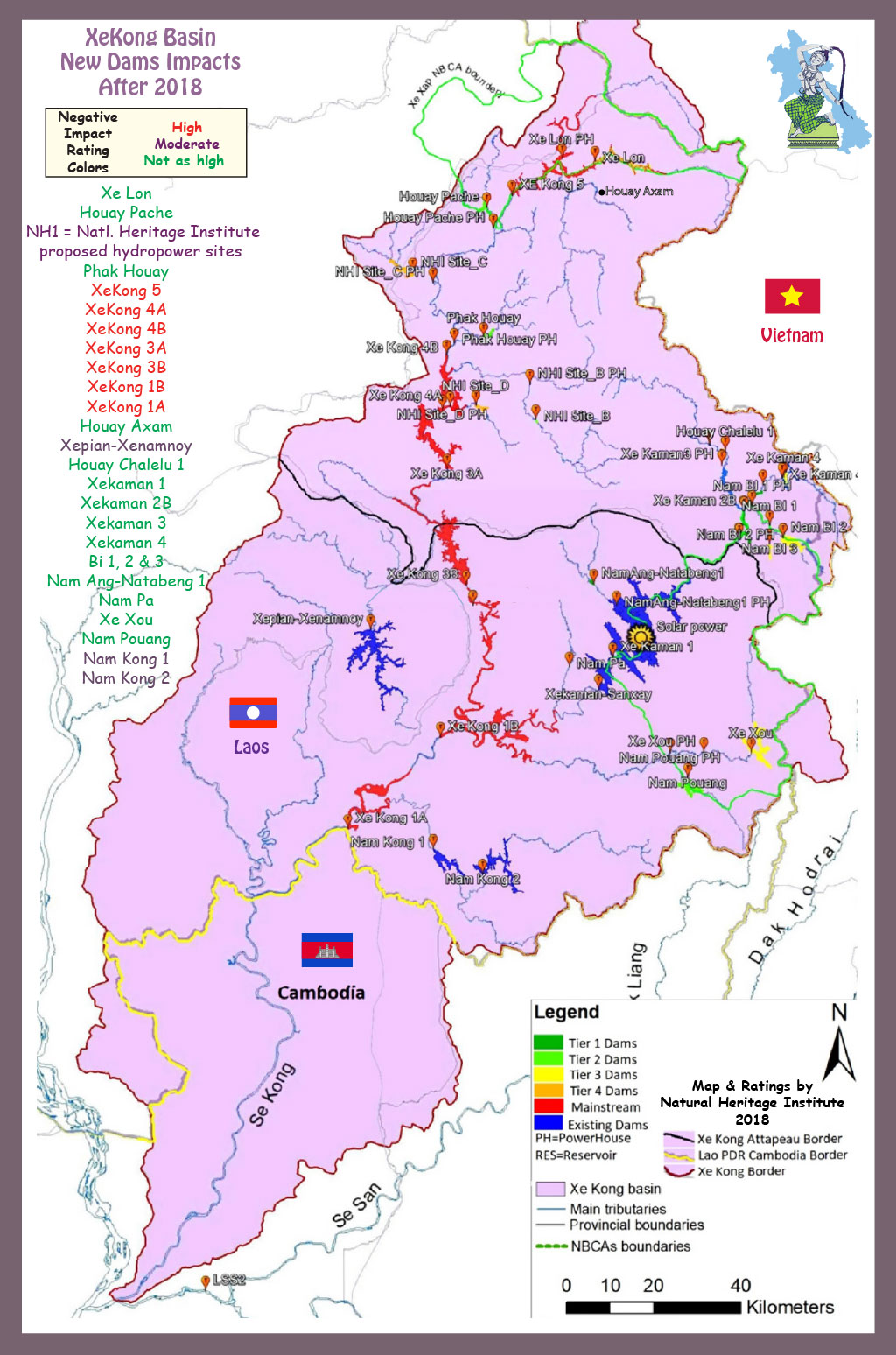
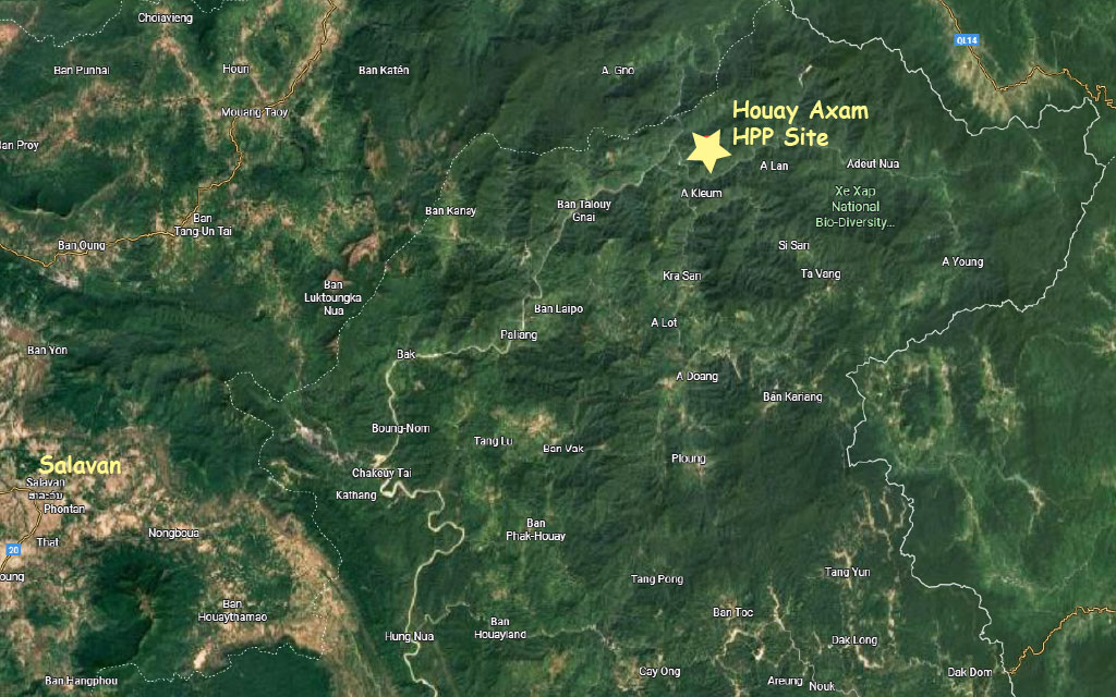
Houay Axam Dam & Powerhouse both seen in center of Xekong Basin map below.
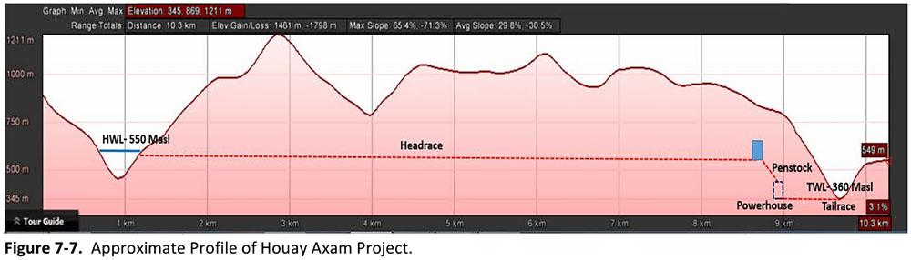
The layout of the project is seen in profile image below with a 7.5 km headrace conduit, a surge tower, penstock, powerhouse and tailrace.
Houay Axam HPP proposed location is seen on image below contained in the Report along with XeLon HPP.
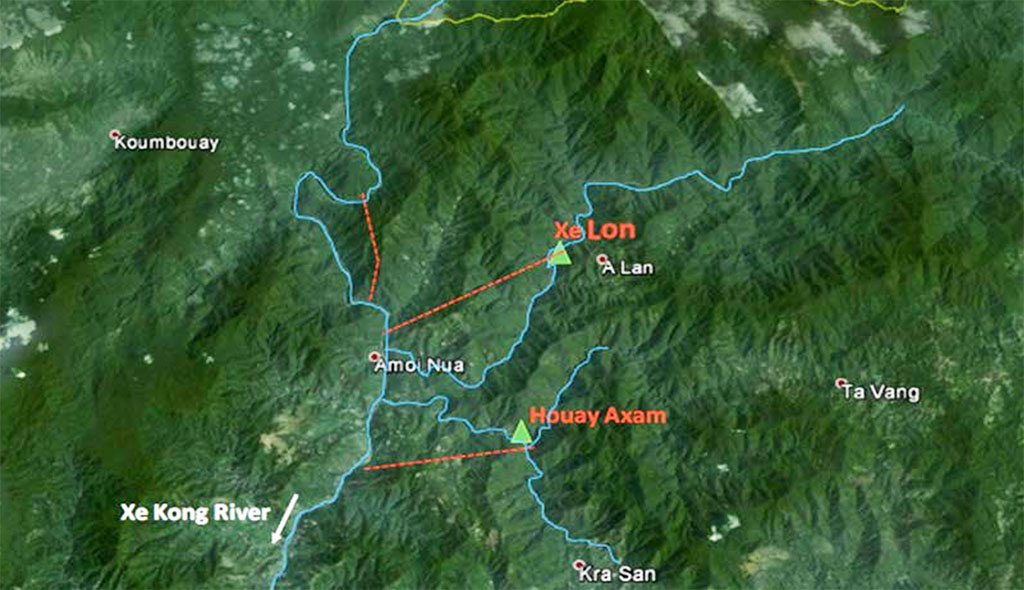
Houay Axam & XeLon HPP sites both on satellite image below.
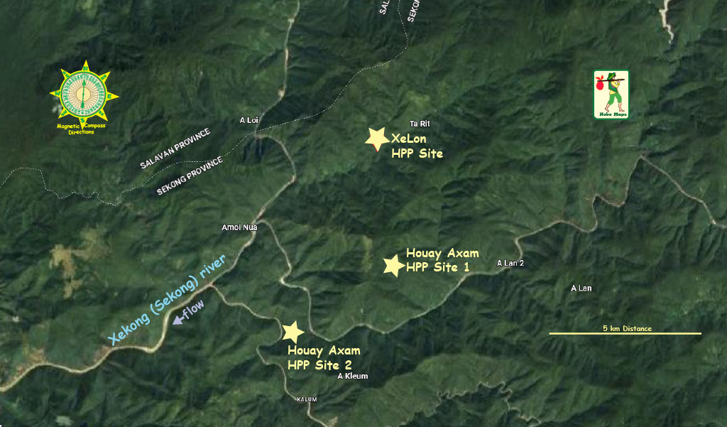
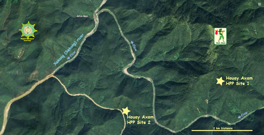
Houay Axam HPP location in satellite images below using two sets of coordinates provided in the NHI Report - Site 1 at 16°01'28.7"N 107°04'24.6"E (16.024643, 107.073487) & Site 2 at 16°00'53.2"N 107°02'38.7"E (16.014786, 107.044092). Not sure if one location is for the Dam location and the other for the Powerhouse or if one is incorrect.
Houay Axam HPP seen in Tier Three section of priority chart below:
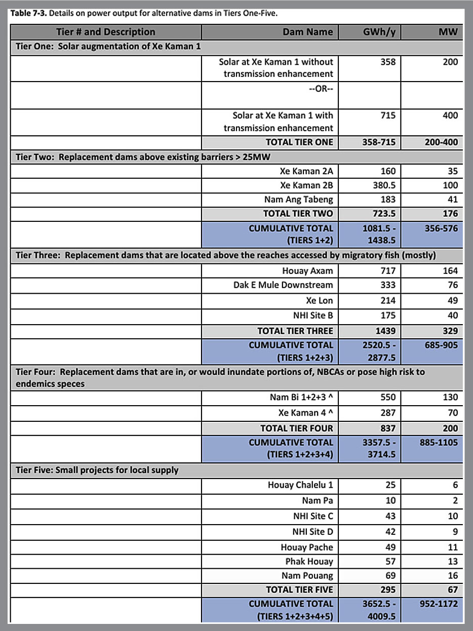
Houay Axam HPP seen in Tier Three section of priority chart below:
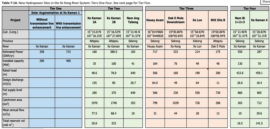
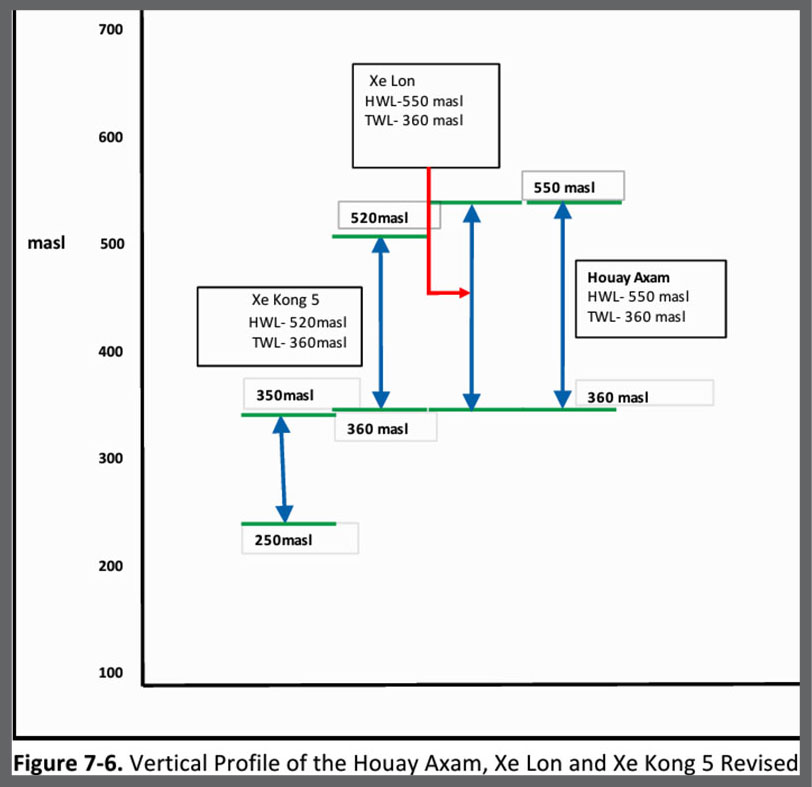
In chart below, Houay Axam reservoir high water level is 550 meters above sea level while tailwater level is 360 masl - a 190 meter difference.