Nam Khan 2 Dam Hydropower Info by Hobo Maps - Go to Hydropower Projects Page - - - HOME
Nam Khan 2 dam is about 68 km upstream from where the Nam Khan river joins the Mekong at Luang Prabang and near the village of Kengkoung about 30 km Southeast of L. Prabang town by direct line.
Nam Khan river originates in Xieng Khouang Province in the mountainous region of Phou Khoun and Xieng Ngeun Districts.
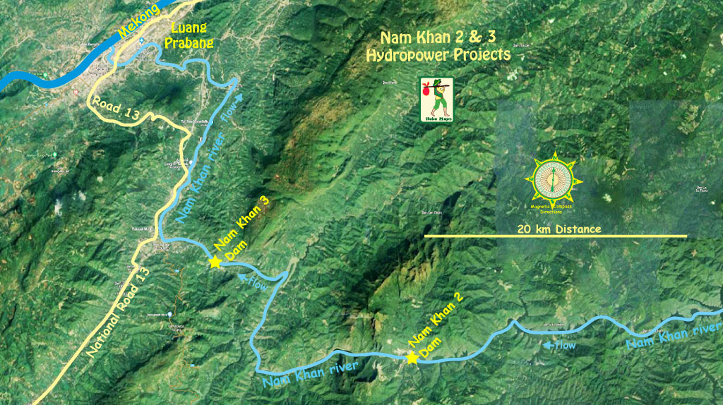
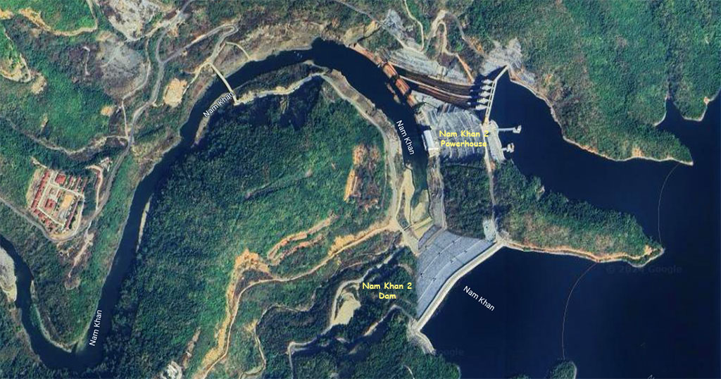
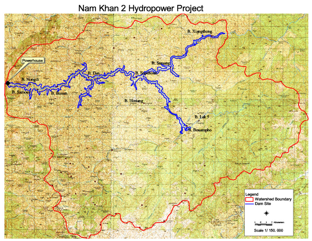
Nam Khan 2 and 3 hydropower project locations are shown in the satellite image below.
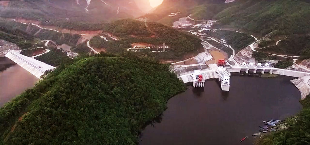
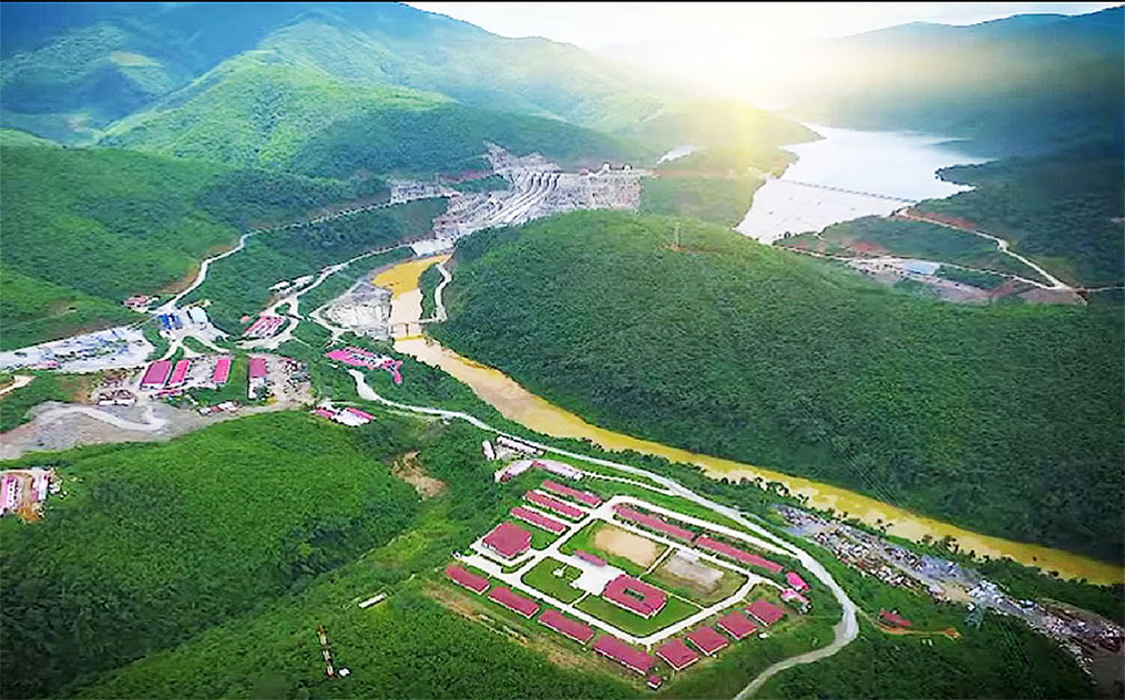
Images below show Nam Khan 2 HPP.

The project is managed and operated by Electricite du Laos (EDL) and entirely owned by EDL GEN.
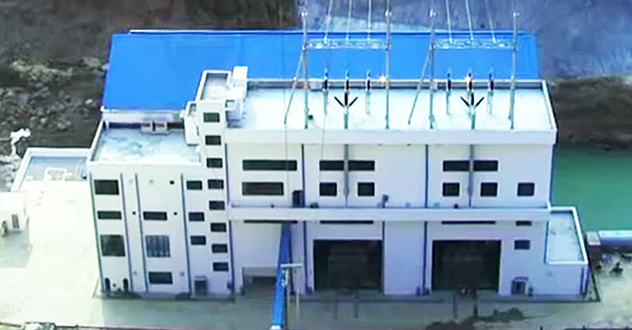
The power plant consists of 2 vertical Francis turbine units at 65 MW each for a combined capacity of 130 MW with ability to generate up to 558 GWh output per year.
Nam Khan 2 dam was constructed by China’s Sinohydro Corporation pursuant to a $308.5 million commercial EPC contract. The project was in part funded by a US$ 292.6 million preferential buyer’s credit loan from Exim Bank of China.
Construction began on March 26, 2011, an impoundment ceremony took place on April 18, 2015 and the project was completed on November 28, 2015 with commercial generation starting in December 2015.
Nam Khan 2 HPP images below:
Access to the Project from Luang Prabang is via National Road 13 and a secondary road that runs along the north side of the Nam Khan river to the dam site about 50 km by road from Luang Prabang town. The plant is 48 km upstream from the Nam Khan 3 plant in Xieng Nguen district of Luang Prabang Province.
Nam Khan 2 is shown in the satellite images below - at coordinates 19°40'59.9"N 102°22'05.9"E (19.683311, 102.368294):

Nam Khan 2 power plant will normally operate during daytime and not at night. This peaking routine according to the demand for electricity will depend on the size of the inflow each day and the amount of water stored in the reservoir. Typical peaking operation may last about 10 to16 hours daily.
A tailrace channel discharges water from the powerhouse directly back to the Nam Khan river. There is no re-regulating pond which means the section of the river just below the powerhouse may have little or no flow in the dry season when the plant is not operating. Further downstream, as tributary streams join the Nam Khan, changes in the river's water levels will not be as drastic.
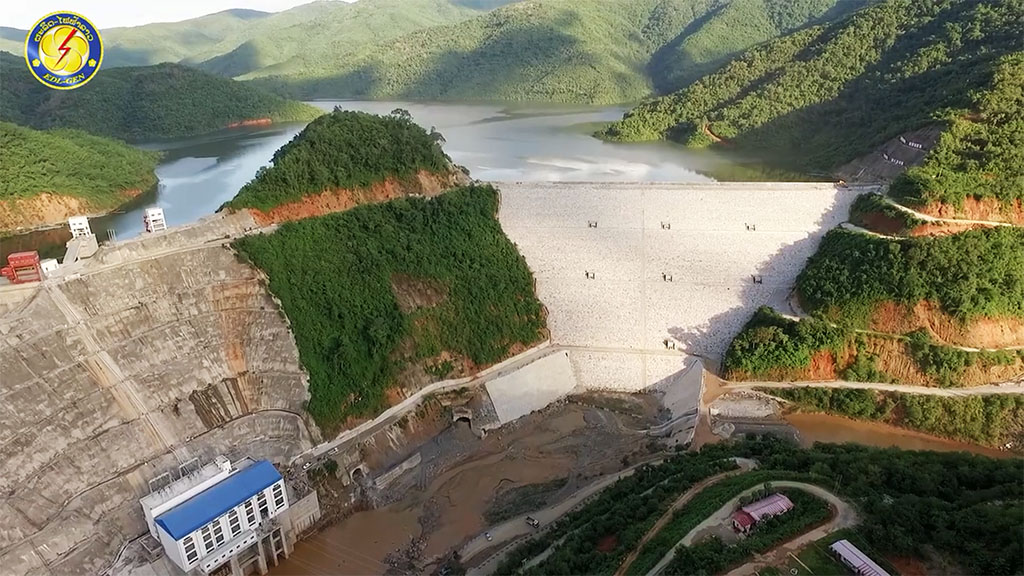
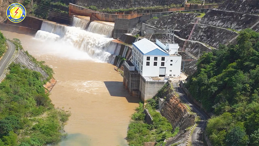
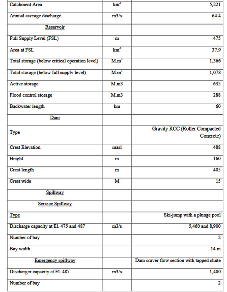
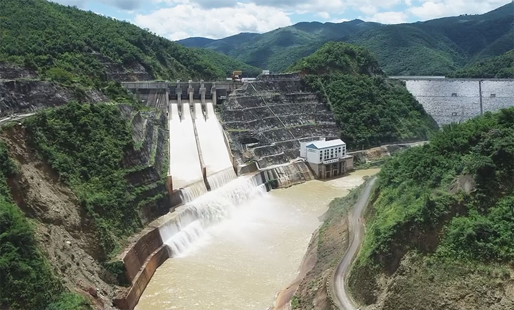
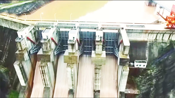
The dam is a gravity Roller-Compacted Concrete structure 365 meters long and 136 meters high with 4 spillways each 13 meters wide.
The river at the dam site is narrow with steep slopes on the banks. The entire head of 119 meters available for power generation is developed by the dam structure.
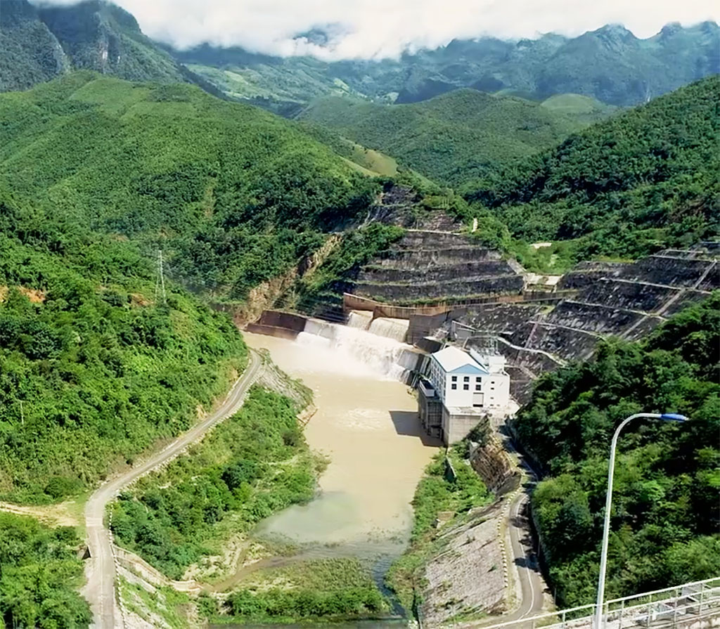
The powerhouse and related structures are located at the foot of the dam.
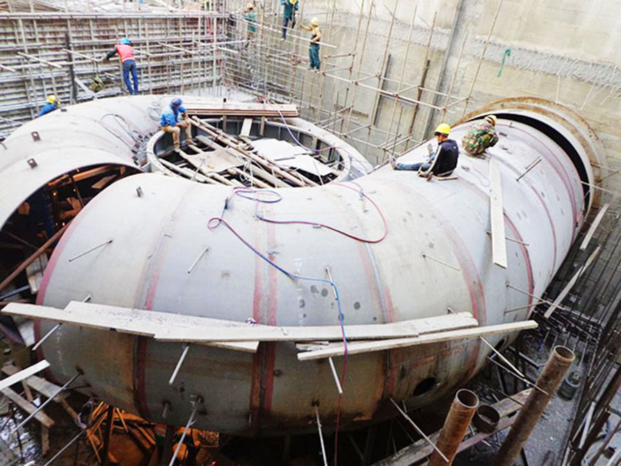
The two turbine units are fed individually by an intake and a penstock 147 meters long with a 4.1 meter diameter.
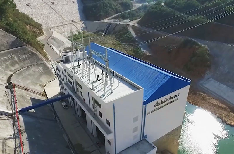
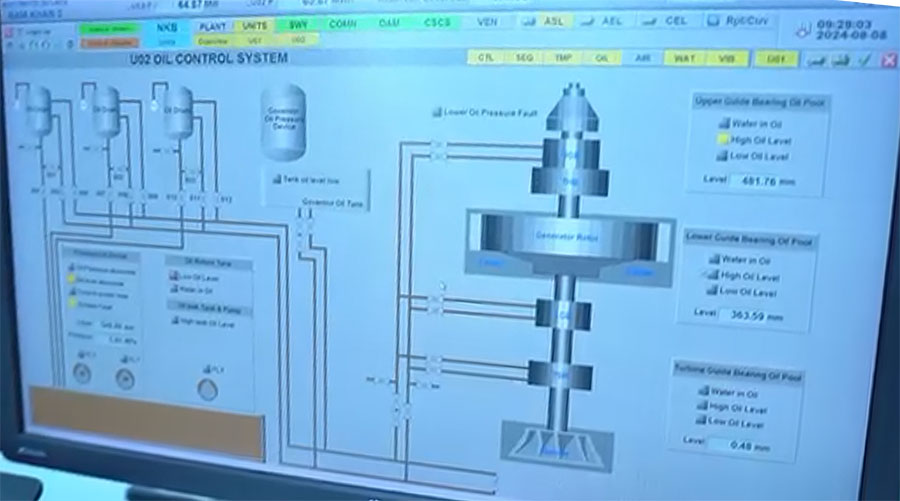
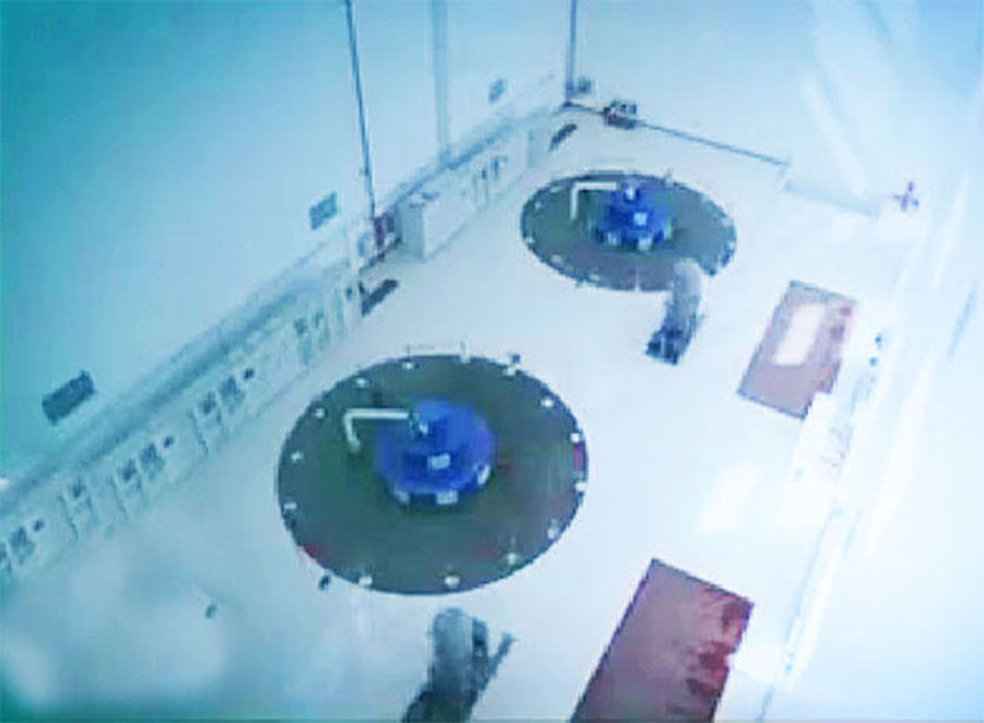
Nam Khan 2 powerhouse images below:

The project has a watershed catchment area of 5,221 square km. The reservoir is less than 1 km wide and has a length of about 60 km extending upstream along the river.
Full Supply Level of the reservoir is at elevation 475 meters above sea level (maybe 477). The reservoir has a surface area of 30 sq km and storage for 686 million cubic meters of water with 528 million of that as active capacity.
The reservoir will normally be filled to Full Supply Level during the wet season from August to October and be drawn down to Minimum Operating Level (465 masl) near the end of the dry season.
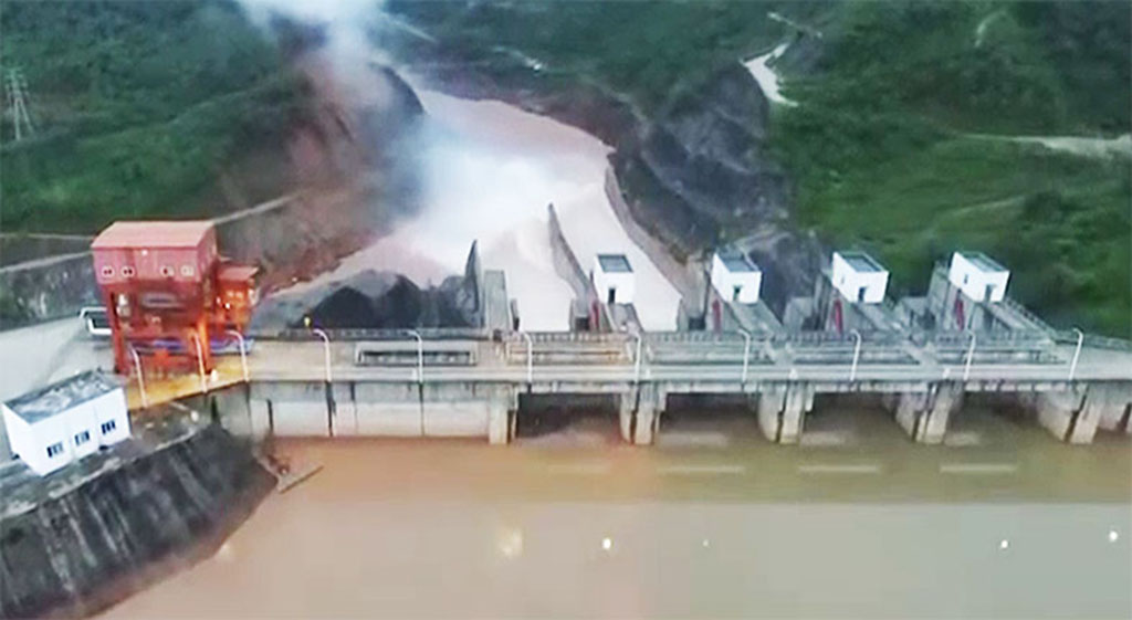
Image below shows the 4 spillway gates of the Nam Khan 2 dam structure.
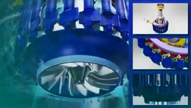
Nam Khan 2 turbine images below:
See nice video of Nam Khan 2 & 3 HERE.
Nam Khan 2 spiral turbine inflow tube image below:
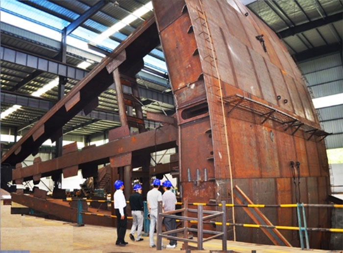
Nam Khan 2 radial gates images below.
The project includes a 115kV transmission line that links to a substation in Xieng Ngeun district of Luang Prabang Province, supplying electricity to the northern provinces and Vientiane Capital.
![]()
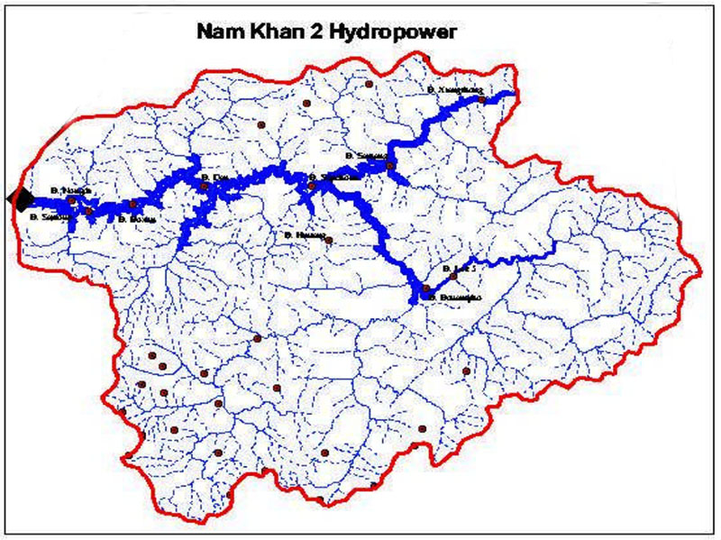
Nam Khan 2 watershed basin images below:
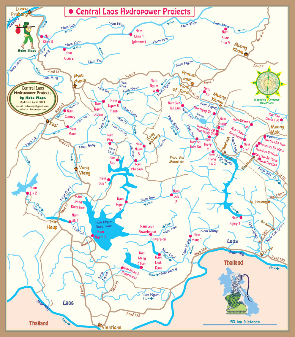
Nam Khan 2 location is seen in the upper left portion of map below:
The Nam Khan 2 project required 9 villages to be relocated about 6 km away from the project.
Nam Khan 2 & 3 HPP planning stats in chart below were subject to change during construction and later:
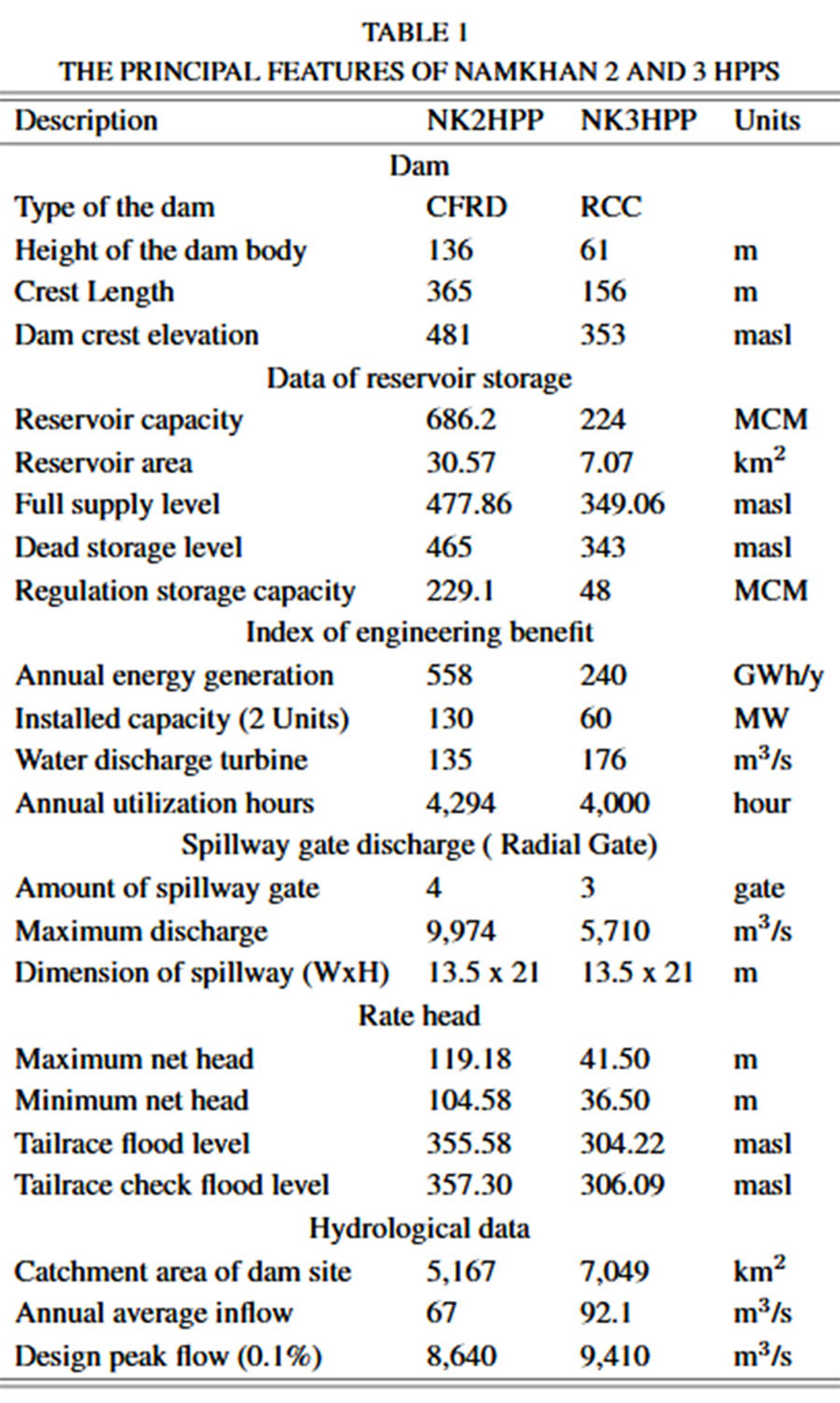
Nam Khan 2 dam planned design stats in chart below may not match actual after construction completion: