Nam Ngiep Area Hydropower Dams info by Hobo Maps - Go to Hydropower Projects Page - - Home
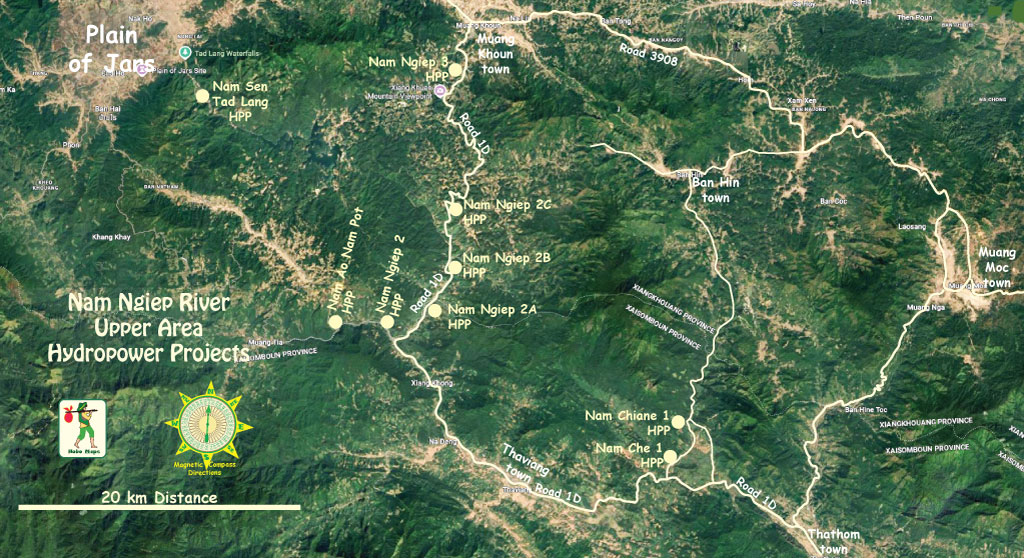
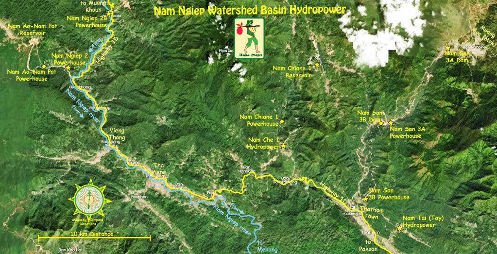
Nine Nam Ngiep river upper area hydropower project locations are seen in the map below:
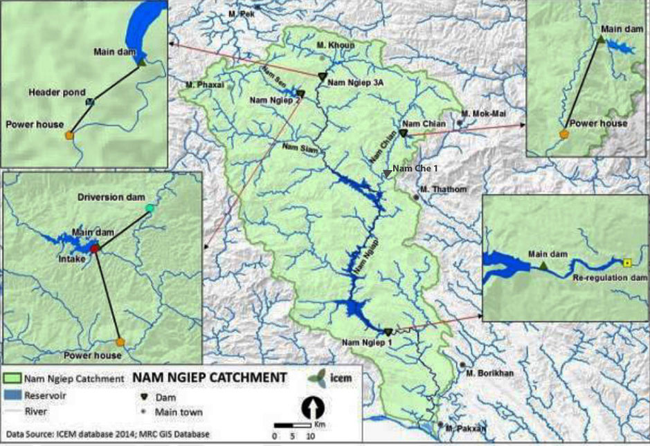
Map of Nam Ngiep catchment area hydropower project locations is below:
Nam Ngiep River Basin can be divided into 3 sections for hydropower development potential.
1 - UPPER: The river section upstream of Muang Khoun is about 20 km long with a fall in elevation of around 90 meters and the gradient is about 4.5% (90/20 = 4.5 meter drop per km) The river course is flat and gentle with the river valley open and wide. There is cultivated land and many villages but the water flow is not great and it is not suitable for hydraulic development.
2 - MID VALLEY SECTION: The mid valley section is below where the Nam Ngiep River joins the Nam Sen River and both turn south flowing into a valley. The valley section is about 35 km long with a fall of about 702 meters (702/35 = 20 meter drop per km). The gradient is 20% where the river course is confined and falls significantly. The river valley has hardly any farmland or people living along the river. The valley section is home to most hydraulic resources of Nam Ngiep basin and good conditions are available for hydropower development.
3 - LOWER: The river section below the confluence of Nam Siam River with the Nam Ngiep and down to the Mekong River is about 140 km long with a fall of about 210 meters (210/140 = 1.5 meter drop per km). The gradient is about 1.5% and the river course is flat and gentle.
The Nam Ngiep 1 Hydropower Project watershed comprises 3,700 sq km of mountainous catchment area with a drop in elevation of 2,600 meters.
The four projects upstream of Nam Ngiep 1 (Nam Ngiep 2, Nam Ngiep 3A, Nam Che 1 and Nam Chiane 1) are situated relatively high in the headwaters of the catchment and rely on large elevation drops in the topography for their electricity production and not on large volume of river flow.
The main features of the cascade hydropower projects upstream of Nam Ngiep 1 HPP are summarized below:
- Nam Ngiep 2 is on the Nam Sen River a tributary of the Nam Ngiep River and about 94 km upstream of the Nam Ngiep 1 dam site. The Nam Ngiep 2 powerhouse is only 10 km away from headwaters of Nam Ngiep 1 reservoir.The project includes a diversion between the Nam Sen and Nam Siam rivers.
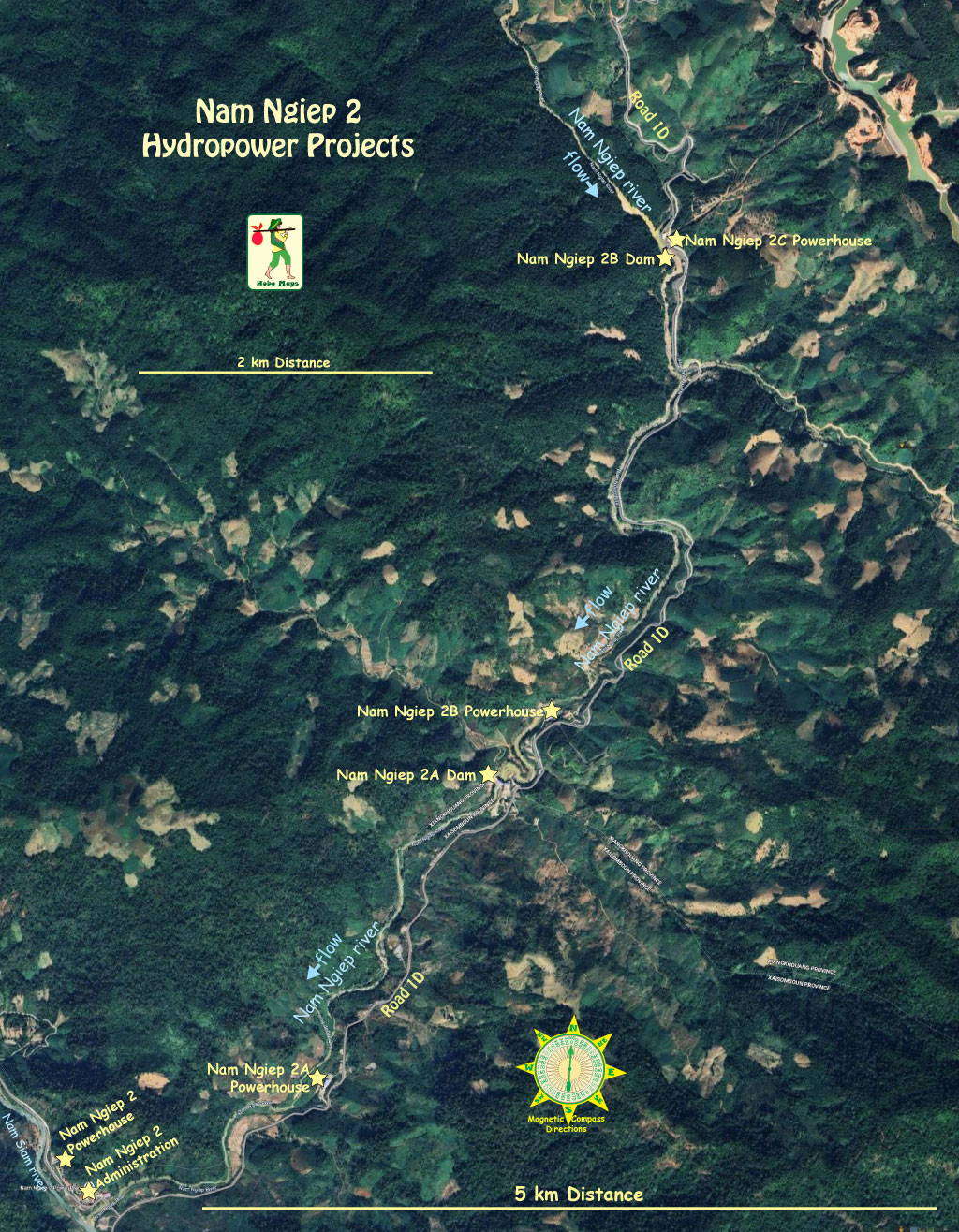
- Nam Ngiep 2A, 2B & 2C are on the Nam Ngiep river in a cascade layout with 2A in the south just above the confluence of Nam Siam river. Nam Ngiep 2B is just above 2A & 2C is above and upriver of 2B. All are developed by the Nonghai Group and reaching completion in 2025.
- Nam Ngiep 3A is on Nam Ngiep river about 100 km upstream of Nam Ngiep 1 dam site and directly upstream of Nam Ngiep 2. It has a small reservoir with small storage capacity.
- Nam Chiane 1 project is on the Nam Tong River, a tributary of the Nam Ngiep River about 74 km upstream of the Nam Ngiep 1 dam site. It has a small storage capacity of 23.12 million cubic meters.
- Nam Che 1 is on the Nam Che river and has a small reservoir just above the powerhouse.
- Nam Ao- Nam Pot project is located on the Nam Siam River west of Nam Ngiep 2.
For more details and images regarding these Nam Ngiep Area hydropower projects see our
- Nam Ao-Nam Pot web page is HERE
- Nam Ngiep 1 web page HERE
- Nam Ngiep 2 web page HERE
- Nam Ngiep 2A web page HERE
- Nam Ngiep 2B web page HERE
- Nam Ngiep 2C web page HERE
- Nam Ngiep 3A web page HERE
- Nam Chiane 1 web page HERE
- Nam Che web page HERE
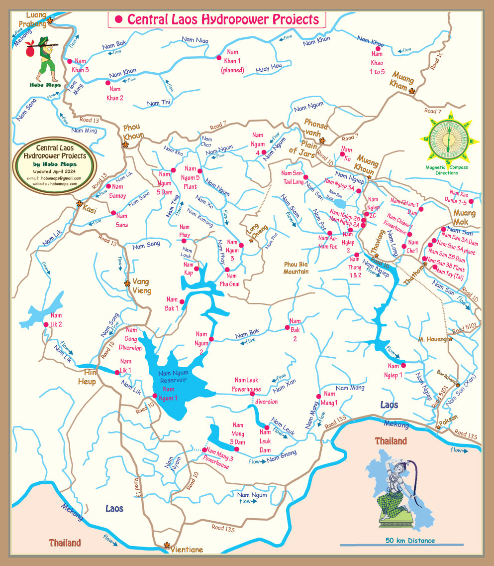
Location of the projects are shown on middle right side of map below:

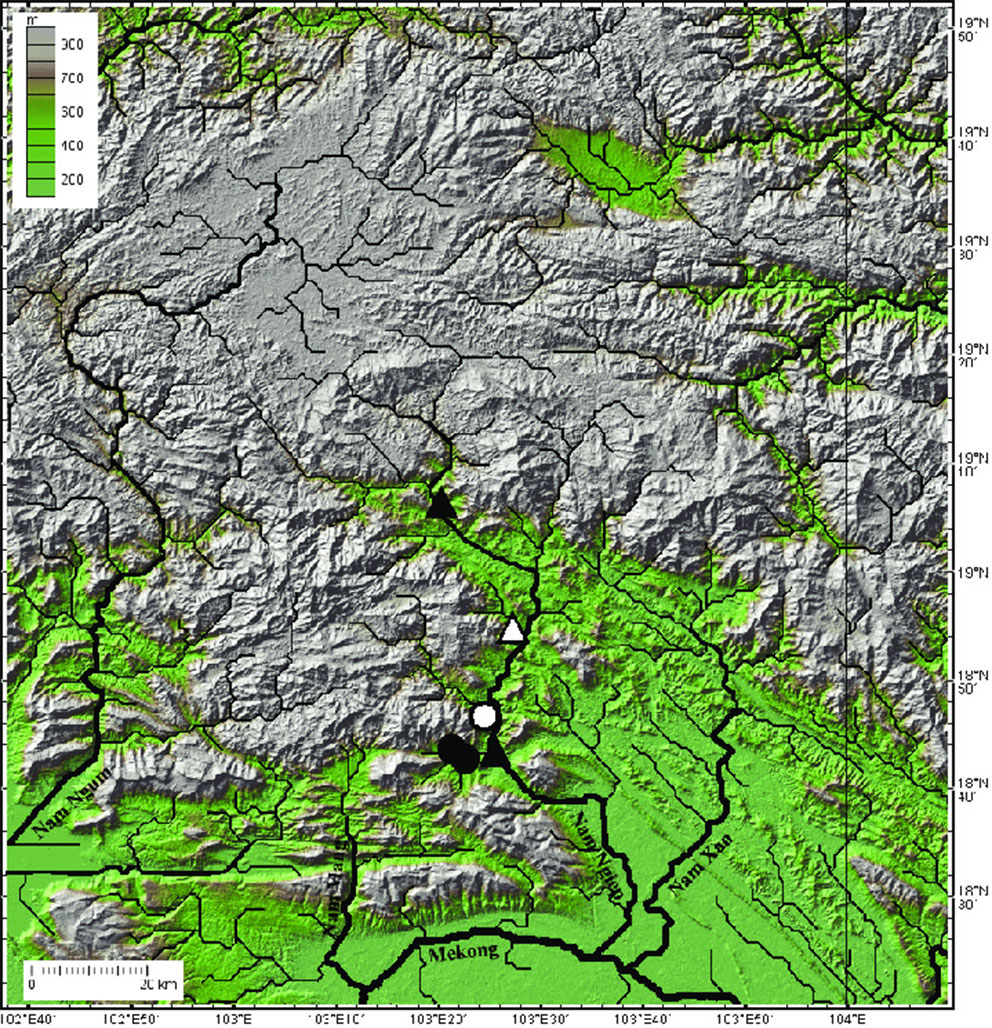
Central Laos relief map below before hydropower reservoirs.