Thakhek Loop Terrain Map Laos - by HoboMaps.com - - - Home
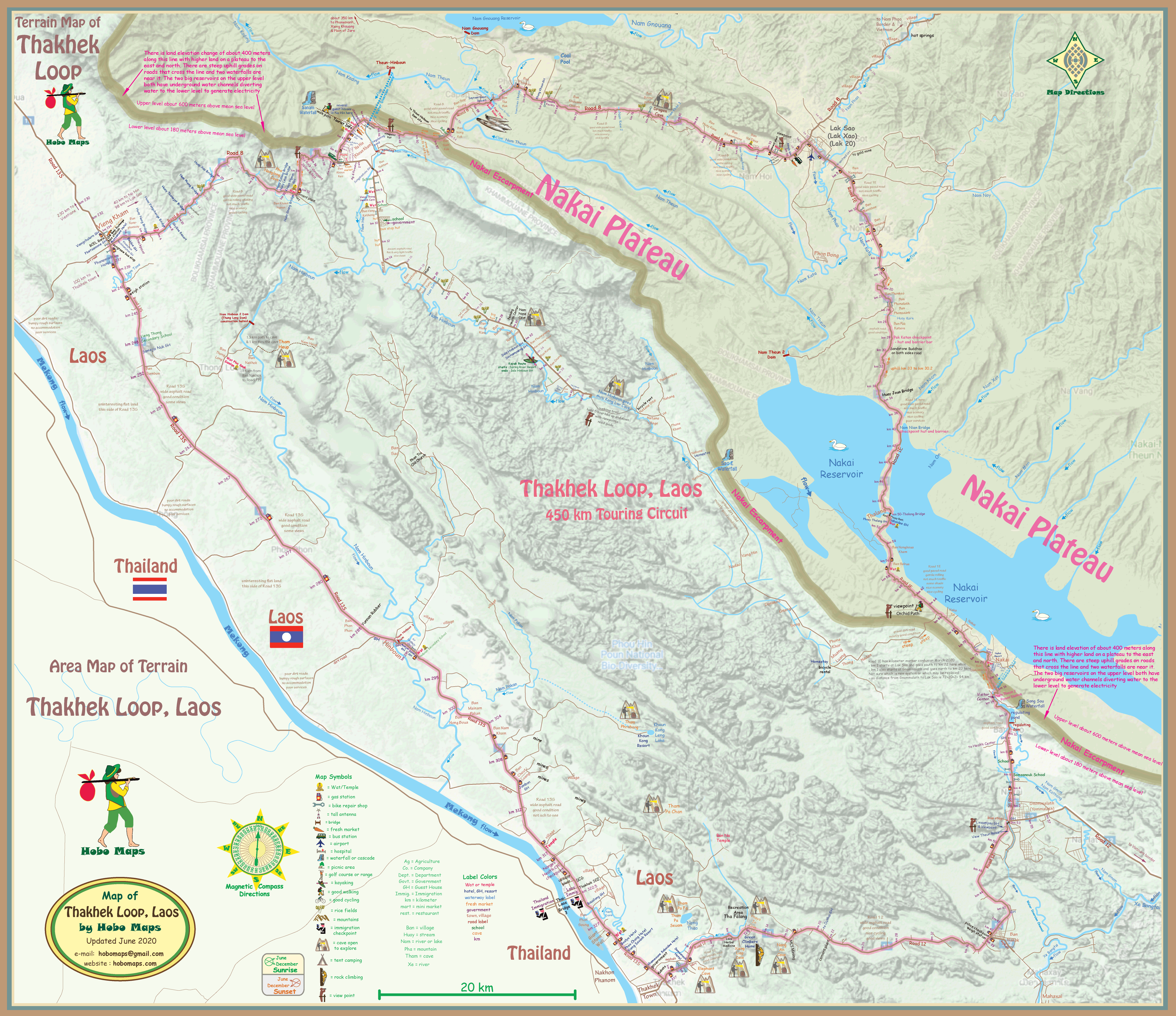
The Terrain Map below shows the Loop area in relief based on satellite imagery. We have added shaded lines to mark the Nakai Escarpment which is an abrupt change in elevation of about 400 meters creating the Nakai Plateau on the higher side. Two major hydroelectric projects and two large reservoirs take advantage of this elevation change by diverting water from the higher level to lower level by long underground tunnels with turbines at the bottom to generate electricity.
The Thakhek Loop Terrain map is also available in PDF format for off-line viewing on computers, tablets & mobiles - $1.00 each - click HERE for info
Click HERE to see our web page with detailed info and images of the major dams in the area of the Thakhek Loop
Click HERE to see our Thakhek Loop Geographic Map
Click HERE to see our Thakhek Loop Drainage Map